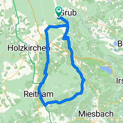
Grubmühle - Maxlmühle, an der Mangfall
A cycling route starting in Valley, Bavaria, Germany.
Overview
About this route
noch in Bearbeitung
auf weitestgehend ruhigen Wegen
- -:--
- Duration
- 18.8 km
- Distance
- 549 m
- Ascent
- 547 m
- Descent
- ---
- Avg. speed
- 670 m
- Avg. speed
Route highlights
Points of interest along the route
Drinking water after 6.2 km
Maxlmühle
Drinking water after 11.2 km
Point of interest after 13.7 km
Drinking water after 17.9 km
Continue with Bikemap
Use, edit, or download this cycling route
You would like to ride Grubmühle - Maxlmühle, an der Mangfall or customize it for your own trip? Here is what you can do with this Bikemap route:
Free features
- Save this route as favorite or in collections
- Copy & plan your own version of this route
- Sync your route with Garmin or Wahoo
Premium features
Free trial for 3 days, or one-time payment. More about Bikemap Premium.
- Navigate this route on iOS & Android
- Export a GPX / KML file of this route
- Create your custom printout (try it for free)
- Download this route for offline navigation
Discover more Premium features.
Get Bikemap PremiumFrom our community
Other popular routes starting in Valley
- Grubmühle - Maxlmühle, an der Mangfall
- Distance
- 18.8 km
- Ascent
- 549 m
- Descent
- 547 m
- Location
- Valley, Bavaria, Germany
- Unterdarching zum Tegernsee, M-Wasserweg
- Distance
- 44.7 km
- Ascent
- 635 m
- Descent
- 637 m
- Location
- Valley, Bavaria, Germany
- Mangfallknie 36km 360hm
- Distance
- 36.1 km
- Ascent
- 368 m
- Descent
- 366 m
- Location
- Valley, Bavaria, Germany
- 13.03.02 Kl. Mangfalltalwanderung von Hohendilching nach Grub
- Distance
- 5.6 km
- Ascent
- 152 m
- Descent
- 154 m
- Location
- Valley, Bavaria, Germany
- 50km Kreuzstr. Schaftlach Kirchsee
- Distance
- 47.9 km
- Ascent
- 378 m
- Descent
- 351 m
- Location
- Valley, Bavaria, Germany
- Kreuzstraße - Spitzing - Kreuzstraße
- Distance
- 103.6 km
- Ascent
- 1,433 m
- Descent
- 1,447 m
- Location
- Valley, Bavaria, Germany
- Kreuzstraße - Sudelfeld - Kreuzstraße
- Distance
- 116.7 km
- Ascent
- 1,616 m
- Descent
- 1,713 m
- Location
- Valley, Bavaria, Germany
- BR 003: (Stuttgart - München Hbf -) Kreuzstraße - Brannenburg
- Distance
- 43.9 km
- Ascent
- 136 m
- Descent
- 240 m
- Location
- Valley, Bavaria, Germany
Open it in the app