
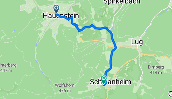
Hauenstein, Jakobsbrunnen nach Hubertusstraße 12, Schwanheim
A cycling route starting in Hauenstein, Rhineland-Palatinate, Germany.
Overview
About this route
- 32 min
- Duration
- 5.4 km
- Distance
- 180 m
- Ascent
- 153 m
- Descent
- 10.2 km/h
- Avg. speed
- 310 m
- Avg. speed

Route quality
Waytypes & surfaces along the route
Waytypes
Road
2.2 km
(41 %)
Track
1.2 km
(23 %)
Surfaces
Paved
4.7 km
(86 %)
Asphalt
4.4 km
(81 %)
Paved (undefined)
0.2 km
(4 %)
Continue with Bikemap
Use, edit, or download this cycling route
You would like to ride Hauenstein, Jakobsbrunnen nach Hubertusstraße 12, Schwanheim or customize it for your own trip? Here is what you can do with this Bikemap route:
Free features
- Save this route as favorite or in collections
- Copy & plan your own version of this route
- Sync your route with Garmin or Wahoo
Premium features
Free trial for 3 days, or one-time payment. More about Bikemap Premium.
- Navigate this route on iOS & Android
- Export a GPX / KML file of this route
- Create your custom printout (try it for free)
- Download this route for offline navigation
Discover more Premium features.
Get Bikemap PremiumFrom our community
Other popular routes starting in Hauenstein
 Rundfahrt Wilgartswiesen
- Distance
- 12.4 km
- Ascent
- 275 m
- Descent
- 275 m
- Location
- Hauenstein, Rhineland-Palatinate, Germany
 Hauensteiner Höhenweg
- Distance
- 18.5 km
- Ascent
- 441 m
- Descent
- 441 m
- Location
- Hauenstein, Rhineland-Palatinate, Germany
 Hauenstein - Dahn Jungfernsprung Ausflugsrunde
- Distance
- 37.1 km
- Ascent
- 781 m
- Descent
- 777 m
- Location
- Hauenstein, Rhineland-Palatinate, Germany
 Schusterland- Radtour in Hauenstein
- Distance
- 62.6 km
- Ascent
- 1,154 m
- Descent
- 1,146 m
- Location
- Hauenstein, Rhineland-Palatinate, Germany
 Rundweg über Wernersberg-Annweiler
- Distance
- 31 km
- Ascent
- 52 m
- Descent
- 150 m
- Location
- Hauenstein, Rhineland-Palatinate, Germany
 Burghalder-Weg in Hauenstein
- Distance
- 10.9 km
- Ascent
- 347 m
- Descent
- 390 m
- Location
- Hauenstein, Rhineland-Palatinate, Germany
 Route 12 simplified
- Distance
- 23.2 km
- Ascent
- 651 m
- Descent
- 650 m
- Location
- Hauenstein, Rhineland-Palatinate, Germany
 443. "Teufelstisch/ Sickinger Höhe/ Luitpoldturm"
- Distance
- 104.5 km
- Ascent
- 820 m
- Descent
- 820 m
- Location
- Hauenstein, Rhineland-Palatinate, Germany
Open it in the app