

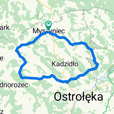
MP trasa czsówki
A cycling route starting in Myszyniec, Masovian Voivodeship, Poland.
Overview
About this route
- -:--
- Duration
- 11.6 km
- Distance
- 35 m
- Ascent
- 36 m
- Descent
- ---
- Avg. speed
- 125 m
- Max. altitude

Route quality
Waytypes & surfaces along the route
Waytypes
Road
10.8 km
(94 %)
Quiet road
0.7 km
(6 %)
Undefined
-0 km
(<1 %)
Surfaces
Paved
11.6 km
(100 %)
Asphalt
10.8 km
(94 %)
Paved (undefined)
0.6 km
(5 %)
Continue with Bikemap
Use, edit, or download this cycling route
You would like to ride MP trasa czsówki or customize it for your own trip? Here is what you can do with this Bikemap route:
Free features
- Save this route as favorite or in collections
- Copy & plan your own version of this route
- Sync your route with Garmin or Wahoo
Premium features
Free trial for 3 days, or one-time payment. More about Bikemap Premium.
- Navigate this route on iOS & Android
- Export a GPX / KML file of this route
- Create your custom printout (try it for free)
- Download this route for offline navigation
Discover more Premium features.
Get Bikemap PremiumFrom our community
Other popular routes starting in Myszyniec
 jyrs
jyrs- Distance
- 1,338.9 km
- Ascent
- 511 m
- Descent
- 511 m
- Location
- Myszyniec, Masovian Voivodeship, Poland
 Kraina kurpiowska drużyn jazda
- Distance
- 4.3 km
- Ascent
- 20 m
- Descent
- 17 m
- Location
- Myszyniec, Masovian Voivodeship, Poland
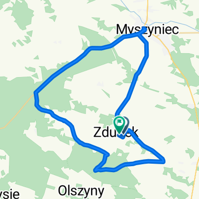
 czasówka
- Distance
- 10.6 km
- Ascent
- 40 m
- Descent
- 41 m
- Location
- Myszyniec, Masovian Voivodeship, Poland
 Drężek do Wykrot
- Distance
- 21.3 km
- Ascent
- 515 m
- Descent
- 333 m
- Location
- Myszyniec, Masovian Voivodeship, Poland
 Myszyniec-Koryta, Myszyniec do Modrzewiowa 38, Myszyniec
- Distance
- 2 km
- Ascent
- 146 m
- Descent
- 150 m
- Location
- Myszyniec, Masovian Voivodeship, Poland
 czasówka
- Distance
- 4.2 km
- Ascent
- 24 m
- Descent
- 23 m
- Location
- Myszyniec, Masovian Voivodeship, Poland
 Myszyniec
- Distance
- 117.6 km
- Ascent
- 58 m
- Descent
- 70 m
- Location
- Myszyniec, Masovian Voivodeship, Poland
 Zdunek do Zdunek
- Distance
- 28.5 km
- Ascent
- 399 m
- Descent
- 397 m
- Location
- Myszyniec, Masovian Voivodeship, Poland
Open it in the app