

Steckborn-Weiningen-Stein
A cycling route starting in Steckborn, Thurgau, Switzerland.
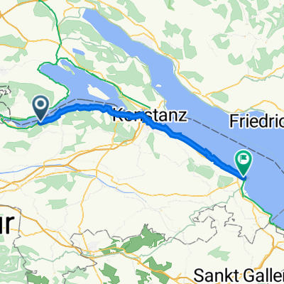
Overview
About this route
Over Seerücken past the Thur meadows to Stein with beautiful views of the mountains and Lake Constance
- -:--
- Duration
- 43 km
- Distance
- 513 m
- Ascent
- 541 m
- Descent
- ---
- Avg. speed
- ---
- Max. altitude
Route quality
Waytypes & surfaces along the route
Waytypes
Quiet road
20.6 km
(48 %)
Track
6.4 km
(15 %)
Surfaces
Paved
31.8 km
(74 %)
Unpaved
6.9 km
(16 %)
Asphalt
29.7 km
(69 %)
Gravel
3.4 km
(8 %)
Continue with Bikemap
Use, edit, or download this cycling route
You would like to ride Steckborn-Weiningen-Stein or customize it for your own trip? Here is what you can do with this Bikemap route:
Free features
- Save this route as favorite or in collections
- Copy & plan your own version of this route
- Sync your route with Garmin or Wahoo
Premium features
Free trial for 3 days, or one-time payment. More about Bikemap Premium.
- Navigate this route on iOS & Android
- Export a GPX / KML file of this route
- Create your custom printout (try it for free)
- Download this route for offline navigation
Discover more Premium features.
Get Bikemap PremiumFrom our community
Other popular routes starting in Steckborn
 Seestrasse 81, Berlingen nach Ackerstrasse 21, Berlingen
- Distance
- 74.1 km
- Ascent
- 487 m
- Descent
- 474 m
- Location
- Steckborn, Thurgau, Switzerland
 De Glariseggerweg 7, Steckborn à Seestrasse 179, Steckborn
- Distance
- 203.7 km
- Ascent
- 156 m
- Descent
- 158 m
- Location
- Steckborn, Thurgau, Switzerland
 09_Besuch bei Napoleon in Arenenberg
- Distance
- 23.7 km
- Ascent
- 566 m
- Descent
- 566 m
- Location
- Steckborn, Thurgau, Switzerland
 Hauptstrasse 13, Mammern to Badstrasse 25, Romanshorn
- Distance
- 41 km
- Ascent
- 478 m
- Descent
- 497 m
- Location
- Steckborn, Thurgau, Switzerland
 Steckborn Kreuzlingen Seerücken Mammern
- Distance
- 48.3 km
- Ascent
- 320 m
- Descent
- 329 m
- Location
- Steckborn, Thurgau, Switzerland
 Bahnhofstrasse 18, Berlingen nach Obergass 19, Stein am Rhein
- Distance
- 15.5 km
- Ascent
- 174 m
- Descent
- 178 m
- Location
- Steckborn, Thurgau, Switzerland
 Glarisegg Eichhölzli
- Distance
- 5.9 km
- Ascent
- 161 m
- Descent
- 161 m
- Location
- Steckborn, Thurgau, Switzerland
 4. Tag Konstanz - Schaffhausen - ich vermute heut wird uns der Allerwerteste beschwerden bereiten
- Distance
- 36 km
- Ascent
- 290 m
- Descent
- 295 m
- Location
- Steckborn, Thurgau, Switzerland
Open it in the app