
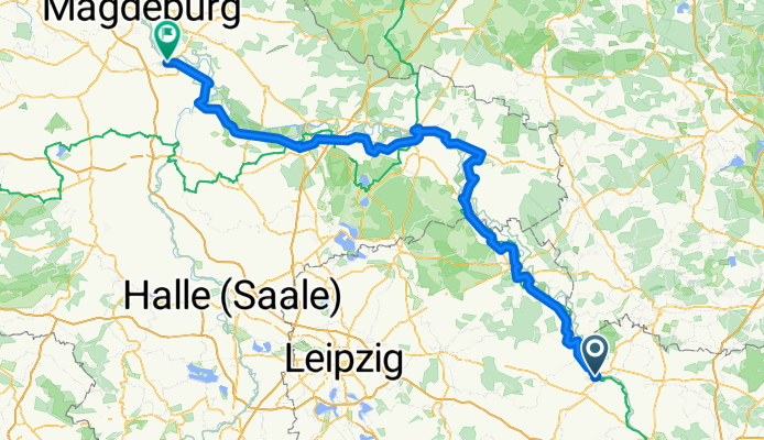
Elberadweg: Riesa - Schönebeck
A cycling route starting in Riesa, Saxony, Germany.
Overview
About this route
250 km mit Besichtigungen und Umwegen,
ständiger Gegenwind von Westen
Erreichte Schnittgeschwindigkeit 14 km mit
Campingausrüstung
durch Biosphärenreservat ist nicht alles befahrbar, oder über Umwege erreichbar,
auf dem Alternativradweg müssen sehr oft Straßen benutzt werden,
- -:--
- Duration
- 209 km
- Distance
- 67 m
- Ascent
- 125 m
- Descent
- ---
- Avg. speed
- ---
- Max. altitude
Route quality
Waytypes & surfaces along the route
Waytypes
Busy road
81.6 km
(39 %)
Quiet road
42.2 km
(20 %)
Surfaces
Paved
156.4 km
(75 %)
Unpaved
8.3 km
(4 %)
Asphalt
140.4 km
(67 %)
Paving stones
9.4 km
(4 %)
Route highlights
Points of interest along the route
Point of interest after 185.8 km
Fähre Groß Rosenburg
Continue with Bikemap
Use, edit, or download this cycling route
You would like to ride Elberadweg: Riesa - Schönebeck or customize it for your own trip? Here is what you can do with this Bikemap route:
Free features
- Save this route as favorite or in collections
- Copy & plan your own version of this route
- Split it into stages to create a multi-day tour
- Sync your route with Garmin or Wahoo
Premium features
Free trial for 3 days, or one-time payment. More about Bikemap Premium.
- Navigate this route on iOS & Android
- Export a GPX / KML file of this route
- Create your custom printout (try it for free)
- Download this route for offline navigation
Discover more Premium features.
Get Bikemap PremiumFrom our community
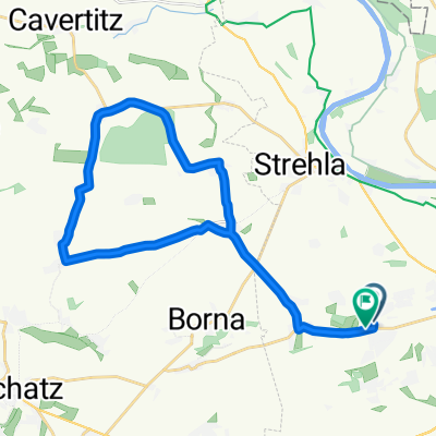
Other popular routes starting in Riesa
 Riesa - Torgau
- Distance
- 51.2 km
- Ascent
- 69 m
- Descent
- 91 m
- Location
- Riesa, Saxony, Germany
 Elbradweg von Riesa nach Lutherstadt Wittenberg
- Distance
- 125 km
- Ascent
- 216 m
- Descent
- 244 m
- Location
- Riesa, Saxony, Germany
 Gemütliche Route Riesa-Niederlommatzsch-Riesa
- Distance
- 33.8 km
- Ascent
- 402 m
- Descent
- 400 m
- Location
- Riesa, Saxony, Germany
 Riesa - Torgau
- Distance
- 49.1 km
- Ascent
- 84 m
- Descent
- 105 m
- Location
- Riesa, Saxony, Germany
 09.09.2021 Meissen_Riesa
- Distance
- 27.4 km
- Ascent
- 50 m
- Descent
- 43 m
- Location
- Riesa, Saxony, Germany
 Kurt-Schlosser-Straße nach Hauptstraße
- Distance
- 5 km
- Ascent
- 26 m
- Descent
- 13 m
- Location
- Riesa, Saxony, Germany
 Trebitz
- Distance
- 25.8 km
- Ascent
- 149 m
- Descent
- 143 m
- Location
- Riesa, Saxony, Germany
 Elberadweg: Riesa - Schönebeck
- Distance
- 209 km
- Ascent
- 67 m
- Descent
- 125 m
- Location
- Riesa, Saxony, Germany
Open it in the app