

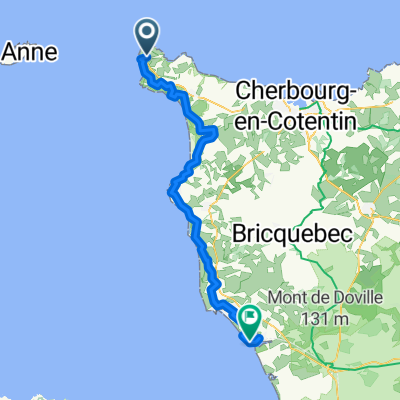
T stage 20..... Auderville – Le Mont-Saint-Michel 10 Sept 2012
A cycling route starting in Beaumont-Hague, Normandy, France.
Overview
About this route
<span><span style="font-size: 9.0pt; font-family: "Verdana","sans-serif"; mso-fareast-font-family: Calibri; mso-fareast-theme-font: minor-latin; mso-bidi-font-family: "Times New Roman"; mso-bidi-theme-font: minor-bidi; color: black; background: white; mso-ansi-language: FR; mso-fareast-language: EN-US; mso-bidi-language: AR-SA;" lang="FR">Mairie d'Auderville</span></span><span style="font-size: 9.0pt; font-family: "Verdana","sans-serif"; mso-fareast-font-family: Calibri; mso-fareast-theme-font: minor-latin; mso-bidi-font-family: "Times New Roman"; mso-bidi-theme-font: minor-bidi; color: black; mso-ansi-language: FR; mso-fareast-language: EN-US; mso-bidi-language: AR-SA;" lang="FR"><br /> <span><span style="background: white;">le bourg</span></span><br /> <span><span style="background: white;">50440 auderville</span></span></span>
to
<span style="color: #000000; font-size: 12px;">Mairie de Le Mont Saint Michel</span><br style="text-decoration: none; font-size: 12px; color: #000000; padding: 0px; margin: 0px;" /><span style="color: #000000; font-size: 12px;">boulevard porte du roy</span><br style="text-decoration: none; font-size: 12px; color: #000000; padding: 0px; margin: 0px;" /><span style="color: #000000; font-size: 12px;">bp 20</span><br style="text-decoration: none; font-size: 12px; color: #000000; padding: 0px; margin: 0px;" /><span style="color: #000000; font-size: 12px;">50170 le mont st michel</span>
- -:--
- Duration
- 168.3 km
- Distance
- 561 m
- Ascent
- 605 m
- Descent
- ---
- Avg. speed
- ---
- Max. altitude

Route quality
Waytypes & surfaces along the route
Waytypes
Quiet road
20.2 km
(12 %)
Road
11.8 km
(7 %)
Surfaces
Paved
121.2 km
(72 %)
Unpaved
3.4 km
(2 %)
Asphalt
121.2 km
(72 %)
Gravel
3.4 km
(2 %)
Undefined
43.8 km
(26 %)
Continue with Bikemap
Use, edit, or download this cycling route
You would like to ride T stage 20..... Auderville – Le Mont-Saint-Michel 10 Sept 2012 or customize it for your own trip? Here is what you can do with this Bikemap route:
Free features
- Save this route as favorite or in collections
- Copy & plan your own version of this route
- Split it into stages to create a multi-day tour
- Sync your route with Garmin or Wahoo
Premium features
Free trial for 3 days, or one-time payment. More about Bikemap Premium.
- Navigate this route on iOS & Android
- Export a GPX / KML file of this route
- Create your custom printout (try it for free)
- Download this route for offline navigation
Discover more Premium features.
Get Bikemap PremiumFrom our community
Other popular routes starting in Beaumont-Hague
 pour aller au landemer
- Distance
- 11.6 km
- Ascent
- 211 m
- Descent
- 205 m
- Location
- Beaumont-Hague, Normandy, France
 Chemin de la Fontaine, La Hague à Rue des Neuf Vergées, La Hague
- Distance
- 33.8 km
- Ascent
- 632 m
- Descent
- 652 m
- Location
- Beaumont-Hague, Normandy, France
 T stage 20..... Auderville – Le Mont-Saint-Michel 10 Sept 2012
- Distance
- 168.3 km
- Ascent
- 561 m
- Descent
- 605 m
- Location
- Beaumont-Hague, Normandy, France
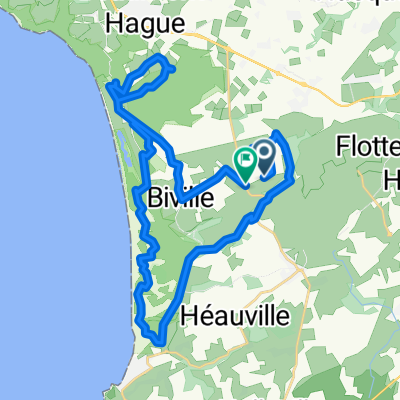
 a-TF13 Auderville - Portbail
- Distance
- 79.5 km
- Ascent
- 1,031 m
- Descent
- 1,089 m
- Location
- Beaumont-Hague, Normandy, France
 Étape 2
- Distance
- 50.7 km
- Ascent
- 828 m
- Descent
- 931 m
- Location
- Beaumont-Hague, Normandy, France
 Jobourg
- Distance
- 7.6 km
- Ascent
- 254 m
- Descent
- 258 m
- Location
- Beaumont-Hague, Normandy, France
 Rue de la Jonquiere nach Rue de la Jonquiere
- Distance
- 20.8 km
- Ascent
- 235 m
- Descent
- 282 m
- Location
- Beaumont-Hague, Normandy, France
 jour 2 mod 2
- Distance
- 52.8 km
- Ascent
- 296 m
- Descent
- 466 m
- Location
- Beaumont-Hague, Normandy, France
Open it in the app