

Forêt noire
A cycling route starting in Gutach im Breisgau, Baden-Wurttemberg, Germany.
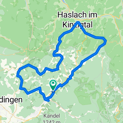
Overview
About this route
- -:--
- Duration
- 22.1 km
- Distance
- 892 m
- Ascent
- 483 m
- Descent
- ---
- Avg. speed
- 1,102 m
- Max. altitude

Route quality
Waytypes & surfaces along the route
Waytypes
Quiet road
6 km
(27 %)
Track
3.5 km
(16 %)
Surfaces
Paved
15.5 km
(70 %)
Unpaved
2.9 km
(13 %)
Asphalt
15.5 km
(70 %)
Gravel
2.9 km
(13 %)
Undefined
3.8 km
(17 %)
Route highlights
Points of interest along the route
Point of interest after 0.2 km
Ville/Village
Point of interest after 1.9 km
Ville/Village
Point of interest after 12 km
Ville / Village
Point of interest after 12 km
Lieu sympa
Point of interest after 12 km
Chutes du Rhin
Point of interest after 12.1 km
Ville/Village
Point of interest after 12.1 km
Lac
Point of interest after 12.2 km
Titisee (Lac)
Point of interest after 18.7 km
Rivières sauvages
Point of interest after 22.1 km
Chutes
Point of interest after 22.1 km
Ville / Village
Point of interest after 22.1 km
Château
Point of interest after 22.1 km
Ville / Village
Point of interest after 22.1 km
Nationalpark Schwarzwald
Continue with Bikemap
Use, edit, or download this cycling route
You would like to ride Forêt noire or customize it for your own trip? Here is what you can do with this Bikemap route:
Free features
- Save this route as favorite or in collections
- Copy & plan your own version of this route
- Sync your route with Garmin or Wahoo
Premium features
Free trial for 3 days, or one-time payment. More about Bikemap Premium.
- Navigate this route on iOS & Android
- Export a GPX / KML file of this route
- Create your custom printout (try it for free)
- Download this route for offline navigation
Discover more Premium features.
Get Bikemap PremiumFrom our community
Other popular routes starting in Gutach im Breisgau
 SC 53 Königstour über den Hochschwarzwald
- Distance
- 188 km
- Ascent
- 3,777 m
- Descent
- 3,777 m
- Location
- Gutach im Breisgau, Baden-Wurttemberg, Germany
 Aufnahme vom 05.06.2017, 22:16
- Distance
- 0 km
- Ascent
- 0 m
- Descent
- 0 m
- Location
- Gutach im Breisgau, Baden-Wurttemberg, Germany
 Lange Radrunde durch Simonswald
- Distance
- 86.1 km
- Ascent
- 536 m
- Descent
- 536 m
- Location
- Gutach im Breisgau, Baden-Wurttemberg, Germany
 Forêt noire
- Distance
- 22.1 km
- Ascent
- 892 m
- Descent
- 483 m
- Location
- Gutach im Breisgau, Baden-Wurttemberg, Germany
 13 ZW3 Waldkirch-Kandel-Hexenloch
- Distance
- 62.6 km
- Ascent
- 1,234 m
- Descent
- 1,233 m
- Location
- Gutach im Breisgau, Baden-Wurttemberg, Germany
 Zur Schutterquelle
- Distance
- 38.9 km
- Ascent
- 667 m
- Descent
- 557 m
- Location
- Gutach im Breisgau, Baden-Wurttemberg, Germany
 Schwarzwaldrunde 12.06.2009 CLONED FROM ROUTE 214166
- Distance
- 147.2 km
- Ascent
- 2,686 m
- Descent
- 2,682 m
- Location
- Gutach im Breisgau, Baden-Wurttemberg, Germany
 klein aber fein vom Elztals ins Kinzigtal
- Distance
- 73.2 km
- Ascent
- 1,213 m
- Descent
- 1,213 m
- Location
- Gutach im Breisgau, Baden-Wurttemberg, Germany
Open it in the app