8 Rue du Sioulot, Orcival to 40 Boulevard de Courtais, Montlu莽on
A cycling route starting in Aydat, Auvergne-Rh么ne-Alpes, France.
Overview
About this route
- 6 h 56 min
- Duration
- 105 km
- Distance
- 1,405 m
- Ascent
- 2,096 m
- Descent
- 15.1 km/h
- Avg. speed
- 902 m
- Max. altitude
Route quality
Waytypes & surfaces along the route
Waytypes
Road
57.7 km
(55 %)
Quiet road
14.7 km
(14 %)
Surfaces
Paved
14.7 km
(14 %)
Unpaved
6.3 km
(6 %)
Asphalt
13.6 km
(13 %)
Gravel
6.3 km
(6 %)
Continue with Bikemap
Use, edit, or download this cycling route
You would like to ride 8 Rue du Sioulot, Orcival to 40 Boulevard de Courtais, Montlu莽on or customize it for your own trip? Here is what you can do with this Bikemap route:
Free features
- Save this route as favorite or in collections
- Copy & plan your own version of this route
- Split it into stages to create a multi-day tour
- Sync your route with Garmin or Wahoo
Premium features
Free trial for 3 days, or one-time payment. More about Bikemap Premium.
- Navigate this route on iOS & Android
- Export a GPX / KML file of this route
- Create your custom printout (try it for free)
- Download this route for offline navigation
Discover more Premium features.
Get Bikemap PremiumFrom our community
Other popular routes starting in Aydat
- Courgoul naar beneden
- Distance
- 98.7 km
- Ascent
- 1,702 m
- Descent
- 1,700 m
- Location
- Aydat, Auvergne-Rh么ne-Alpes, France
- 2.etapa Saint-Nectaire - Mont-Dore
- Distance
- 41.7 km
- Ascent
- 912 m
- Descent
- 558 m
- Location
- Aydat, Auvergne-Rh么ne-Alpes, France
- 8 Rue du Sioulot, Orcival to 40 Boulevard de Courtais, Montlu莽on
- Distance
- 105 km
- Ascent
- 1,405 m
- Descent
- 2,096 m
- Location
- Aydat, Auvergne-Rh么ne-Alpes, France
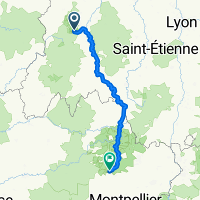
- St.Nectaire - MontDore (Puy de Sancy) St.Nectaire
- Distance
- 58.3 km
- Ascent
- 1,346 m
- Descent
- 1,340 m
- Location
- Aydat, Auvergne-Rh么ne-Alpes, France
- Rondje Murol
- Distance
- 23.6 km
- Ascent
- 408 m
- Descent
- 408 m
- Location
- Aydat, Auvergne-Rh么ne-Alpes, France
- Courgoul-Besse
- Distance
- 114 km
- Ascent
- 1,918 m
- Descent
- 1,918 m
- Location
- Aydat, Auvergne-Rh么ne-Alpes, France
- St Nectaire-Col Croix Morand
- Distance
- 66.5 km
- Ascent
- 976 m
- Descent
- 976 m
- Location
- Aydat, Auvergne-Rh么ne-Alpes, France
- TMC2_Orcival-Allanche
- Distance
- 87.2 km
- Ascent
- 2,106 m
- Descent
- 2,023 m
- Location
- Aydat, Auvergne-Rh么ne-Alpes, France
Open it in the app