

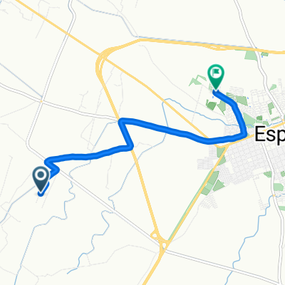
Chicoral Gualanday
A cycling route starting in Espinal, Tolima Department, Colombia.
Overview
About this route
Circuit with low demands, recommended for Sunday leisure mountain bikers.
- -:--
- Duration
- 29.4 km
- Distance
- 305 m
- Ascent
- 306 m
- Descent
- ---
- Avg. speed
- ---
- Max. altitude
Continue with Bikemap
Use, edit, or download this cycling route
You would like to ride Chicoral Gualanday or customize it for your own trip? Here is what you can do with this Bikemap route:
Free features
- Save this route as favorite or in collections
- Copy & plan your own version of this route
- Sync your route with Garmin or Wahoo
Premium features
Free trial for 3 days, or one-time payment. More about Bikemap Premium.
- Navigate this route on iOS & Android
- Export a GPX / KML file of this route
- Create your custom printout (try it for free)
- Download this route for offline navigation
Discover more Premium features.
Get Bikemap PremiumFrom our community
Other popular routes starting in Espinal
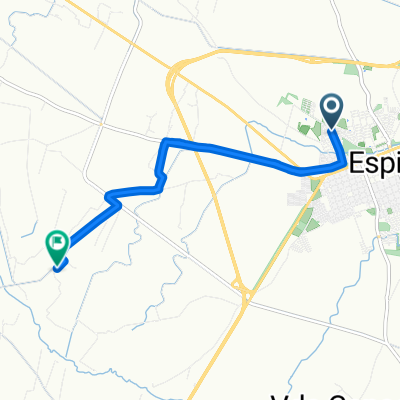
 De Carrera 9ªN, Espinal a Carrera 9ªN, Espinal
- Distance
- 22.6 km
- Ascent
- 144 m
- Descent
- 142 m
- Location
- Espinal, Tolima Department, Colombia
 De Vía Sin Nombre a Parque Praderas del Norte
- Distance
- 7.3 km
- Ascent
- 41 m
- Descent
- 69 m
- Location
- Espinal, Tolima Department, Colombia
 De Carrera 9ªN, Espinal a Carrera 9ªN, Espinal
- Distance
- 32.6 km
- Ascent
- 204 m
- Descent
- 204 m
- Location
- Espinal, Tolima Department, Colombia
 Espinal Neiva (Tolima Huila)
- Distance
- 162 km
- Ascent
- 389 m
- Descent
- 240 m
- Location
- Espinal, Tolima Department, Colombia
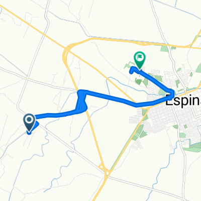
 Ruta moderata
- Distance
- 28.4 km
- Ascent
- 110 m
- Descent
- 81 m
- Location
- Espinal, Tolima Department, Colombia
 Relaxed route in El Espinal
- Distance
- 26.2 km
- Ascent
- 83 m
- Descent
- 82 m
- Location
- Espinal, Tolima Department, Colombia
 De Vía Sin Nombre a Parque Praderas del Norte
- Distance
- 21.9 km
- Ascent
- 41 m
- Descent
- 76 m
- Location
- Espinal, Tolima Department, Colombia
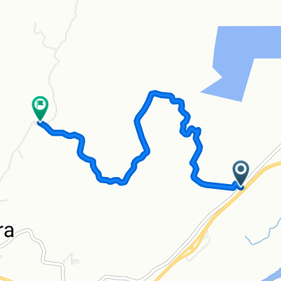 Alternativa circuito Chicoral
- Distance
- 5.4 km
- Ascent
- 395 m
- Descent
- 343 m
- Location
- Espinal, Tolima Department, Colombia
Open it in the app