

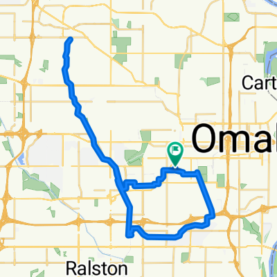
Two Bridge Tour
A cycling route starting in Omaha, Nebraska, United States.
Overview
About this route
- -:--
- Duration
- 22.9 km
- Distance
- 226 m
- Ascent
- 227 m
- Descent
- ---
- Avg. speed
- 366 m
- Max. altitude
Route quality
Waytypes & surfaces along the route
Waytypes
Cycleway
12.1 km
(53 %)
Quiet road
4.8 km
(21 %)
Surfaces
Paved
18.8 km
(82 %)
Unpaved
0.2 km
(1 %)
Concrete
13.7 km
(60 %)
Paved (undefined)
3.4 km
(15 %)
Continue with Bikemap
Use, edit, or download this cycling route
You would like to ride Two Bridge Tour or customize it for your own trip? Here is what you can do with this Bikemap route:
Free features
- Save this route as favorite or in collections
- Copy & plan your own version of this route
- Sync your route with Garmin or Wahoo
Premium features
Free trial for 3 days, or one-time payment. More about Bikemap Premium.
- Navigate this route on iOS & Android
- Export a GPX / KML file of this route
- Create your custom printout (try it for free)
- Download this route for offline navigation
Discover more Premium features.
Get Bikemap PremiumFrom our community
Other popular routes starting in Omaha
 michaels crafts route there
- Distance
- 18.3 km
- Ascent
- 167 m
- Descent
- 171 m
- Location
- Omaha, Nebraska, United States
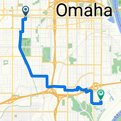
 Burt St, Omaha to Keystone Trail, Omaha
- Distance
- 5.6 km
- Ascent
- 28 m
- Descent
- 81 m
- Location
- Omaha, Nebraska, United States
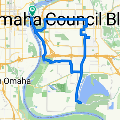
 Burt St, Omaha to Lake Cunningham Trail, Omaha
- Distance
- 17.7 km
- Ascent
- 81 m
- Descent
- 103 m
- Location
- Omaha, Nebraska, United States
 Rivers Edge Parkway 4250, Council Bluffs to Harry Langdon Boulevard 4102, Council Bluffs
- Distance
- 21.4 km
- Ascent
- 64 m
- Descent
- 65 m
- Location
- Omaha, Nebraska, United States
 north little papio [ local loop
- Distance
- 33.7 km
- Ascent
- 108 m
- Descent
- 108 m
- Location
- Omaha, Nebraska, United States
 Omaha to Council Bluffs
- Distance
- 27.9 km
- Ascent
- 93 m
- Descent
- 95 m
- Location
- Omaha, Nebraska, United States
 ride through Omaha
- Distance
- 12.5 km
- Ascent
- 140 m
- Descent
- 142 m
- Location
- Omaha, Nebraska, United States
 Route in Omaha
- Distance
- 7.9 km
- Ascent
- 85 m
- Descent
- 110 m
- Location
- Omaha, Nebraska, United States
Open it in the app