

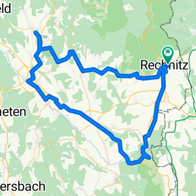
"alpannonia"Etappe 6 Geschriebenstein/Pass– Kőszeg
A cycling route starting in Rechnitz, Burgenland, Austria.
Overview
About this route
From the highest point of Burgenland to Hungary
- 3 h 27 min
- Duration
- 16.3 km
- Distance
- 323 m
- Ascent
- 846 m
- Descent
- 4.7 km/h
- Avg. speed
- 882 m
- Max. altitude

Continue with Bikemap
Use, edit, or download this cycling route
You would like to ride "alpannonia"Etappe 6 Geschriebenstein/Pass– Kőszeg or customize it for your own trip? Here is what you can do with this Bikemap route:
Free features
- Save this route as favorite or in collections
- Copy & plan your own version of this route
- Sync your route with Garmin or Wahoo
Premium features
Free trial for 3 days, or one-time payment. More about Bikemap Premium.
- Navigate this route on iOS & Android
- Export a GPX / KML file of this route
- Create your custom printout (try it for free)
- Download this route for offline navigation
Discover more Premium features.
Get Bikemap PremiumFrom our community
Other popular routes starting in Rechnitz
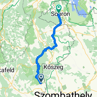 2026 Burgenland 6a: Rechnitz-Sopron
- Distance
- 64.9 km
- Ascent
- 955 m
- Descent
- 1,076 m
- Location
- Rechnitz, Burgenland, Austria
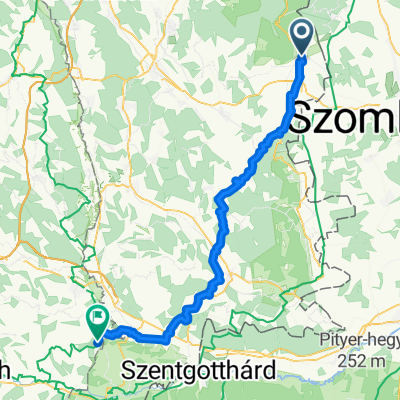
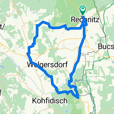
 Rohonc-Vashegy-Felsőőr-Városszalónak-Rohonc
- Distance
- 75.2 km
- Ascent
- 866 m
- Descent
- 865 m
- Location
- Rechnitz, Burgenland, Austria
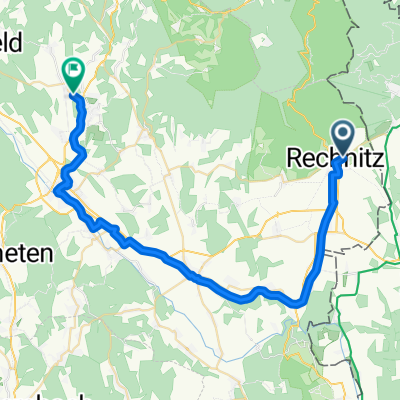
 Rohonc-Németújvár- Vashegy-Rohonc
- Distance
- 97.2 km
- Ascent
- 796 m
- Descent
- 796 m
- Location
- Rechnitz, Burgenland, Austria
 Sommertour 2025 Tag 3
- Distance
- 63.9 km
- Ascent
- 692 m
- Descent
- 702 m
- Location
- Rechnitz, Burgenland, Austria
 Bahntrassen-Radweg
- Distance
- 41.3 km
- Ascent
- 269 m
- Descent
- 211 m
- Location
- Rechnitz, Burgenland, Austria
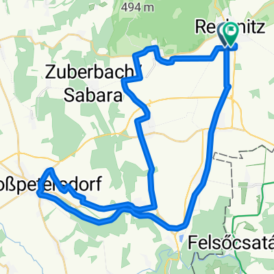
 Rechnitz Oberwart Zuberbach Rechnitz
- Distance
- 59.8 km
- Ascent
- 474 m
- Descent
- 550 m
- Location
- Rechnitz, Burgenland, Austria
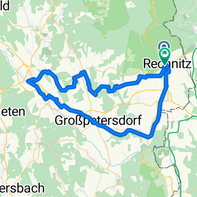
 Rechnitz Eisenberg Großpetersdorf Rechnitz
- Distance
- 51.6 km
- Ascent
- 720 m
- Descent
- 683 m
- Location
- Rechnitz, Burgenland, Austria
Open it in the app