

Sergy Grignan par les cols
Sergy - Culoz par Grand Colombier
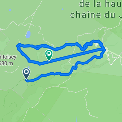
A cycling route starting in Sergy, Auvergne-Rhône-Alpes, France.
Overview
About this route
- -:--
- Duration
- 89.2 km
- Distance
- 2,024 m
- Ascent
- 2,249 m
- Descent
- ---
- Avg. speed
- 1,498 m
- Max. altitude

Part of
Sergy Grignan par les cols
5 stages
Route quality
Waytypes & surfaces along the route
Waytypes
Road
53.5 km
(60 %)
Quiet road
9.8 km
(11 %)
Surfaces
Paved
44.6 km
(50 %)
Unpaved
4.5 km
(5 %)
Asphalt
44.6 km
(50 %)
Loose gravel
4.5 km
(5 %)
Undefined
40.1 km
(45 %)
Continue with Bikemap
Use, edit, or download this cycling route
You would like to ride Sergy - Culoz par Grand Colombier or customize it for your own trip? Here is what you can do with this Bikemap route:
Free features
- Save this route as favorite or in collections
- Copy & plan your own version of this route
- Split it into stages to create a multi-day tour
- Sync your route with Garmin or Wahoo
Premium features
Free trial for 3 days, or one-time payment. More about Bikemap Premium.
- Navigate this route on iOS & Android
- Export a GPX / KML file of this route
- Create your custom printout (try it for free)
- Download this route for offline navigation
Discover more Premium features.
Get Bikemap PremiumFrom our community
Other popular routes starting in Sergy
 Route Jura #1
- Distance
- 61.1 km
- Ascent
- 1,461 m
- Descent
- 1,380 m
- Location
- Sergy, Auvergne-Rhône-Alpes, France
 Big Bang Passport
- Distance
- 54.5 km
- Ascent
- 490 m
- Descent
- 490 m
- Location
- Sergy, Auvergne-Rhône-Alpes, France
 Sergy - Culoz par Grand Colombier
- Distance
- 89.2 km
- Ascent
- 2,024 m
- Descent
- 2,249 m
- Location
- Sergy, Auvergne-Rhône-Alpes, France
 Crozet à Crozet
- Distance
- 10.3 km
- Ascent
- 994 m
- Descent
- 1,003 m
- Location
- Sergy, Auvergne-Rhône-Alpes, France
 Sergy-Passrunde
- Distance
- 98.7 km
- Ascent
- 1,421 m
- Descent
- 1,421 m
- Location
- Sergy, Auvergne-Rhône-Alpes, France
 Givrine par Genolier
- Distance
- 83.8 km
- Ascent
- 2,550 m
- Descent
- 2,548 m
- Location
- Sergy, Auvergne-Rhône-Alpes, France
 Lelex - Lavans Vuillafans
- Distance
- 133.1 km
- Ascent
- 1,108 m
- Descent
- 1,388 m
- Location
- Sergy, Auvergne-Rhône-Alpes, France
 Sergy Motz etape 1 - direct
- Distance
- 57.7 km
- Ascent
- 625 m
- Descent
- 654 m
- Location
- Sergy, Auvergne-Rhône-Alpes, France
Open it in the app