
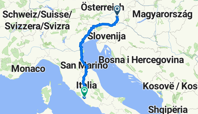
Pfanghofweg 63, Graz nach Via Celio Vibenna, Rom
A cycling route starting in Stattegg, Styria, Austria.
Overview
About this route
- 63 h 37 min
- Duration
- 978.1 km
- Distance
- 10,114 m
- Ascent
- 10,492 m
- Descent
- 15.4 km/h
- Avg. speed
- 841 m
- Max. altitude

Route quality
Waytypes & surfaces along the route
Waytypes
Quiet road
318.2 km
(33 %)
Road
233 km
(24 %)
Surfaces
Paved
621.1 km
(63 %)
Unpaved
39.3 km
(4 %)
Asphalt
570.9 km
(58 %)
Paved (undefined)
45 km
(5 %)
Continue with Bikemap
Use, edit, or download this cycling route
You would like to ride Pfanghofweg 63, Graz nach Via Celio Vibenna, Rom or customize it for your own trip? Here is what you can do with this Bikemap route:
Free features
- Save this route as favorite or in collections
- Copy & plan your own version of this route
- Split it into stages to create a multi-day tour
- Sync your route with Garmin or Wahoo
Premium features
Free trial for 3 days, or one-time payment. More about Bikemap Premium.
- Navigate this route on iOS & Android
- Export a GPX / KML file of this route
- Create your custom printout (try it for free)
- Download this route for offline navigation
Discover more Premium features.
Get Bikemap PremiumFrom our community
Other popular routes starting in Stattegg
 Gipfelsturm schöckl mit umweg
- Distance
- 26.6 km
- Ascent
- 1,479 m
- Descent
- 480 m
- Location
- Stattegg, Styria, Austria
 Moderate Samstag Track In Stattegg
- Distance
- 8.6 km
- Ascent
- 160 m
- Descent
- 442 m
- Location
- Stattegg, Styria, Austria
 Maxi pfeifferhof 😊
- Distance
- 4.9 km
- Ascent
- 180 m
- Descent
- 135 m
- Location
- Stattegg, Styria, Austria
 rannachrunde
- Distance
- 22.7 km
- Ascent
- 570 m
- Descent
- 579 m
- Location
- Stattegg, Styria, Austria
 Schnee 😊 falsch graben
- Distance
- 4.3 km
- Ascent
- 442 m
- Descent
- 356 m
- Location
- Stattegg, Styria, Austria
 Erhardhöhe
- Distance
- 15.6 km
- Ascent
- 660 m
- Descent
- 657 m
- Location
- Stattegg, Styria, Austria
 stattrggerwald
- Distance
- 7.8 km
- Ascent
- 169 m
- Descent
- 164 m
- Location
- Stattegg, Styria, Austria
 Von der Kalkleiten auf den Schöckel
- Distance
- 39 km
- Ascent
- 953 m
- Descent
- 1,247 m
- Location
- Stattegg, Styria, Austria
Open it in the app