

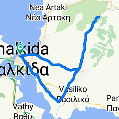
Παπαστρατή 22, Χαλκίδα to Στρατηγού Ιωάννη Λειβαρά 28, Χαλκίδα
A cycling route starting in Chalcis, Central Greece, Greece.
Overview
About this route
- 1 h 43 min
- Duration
- 21.1 km
- Distance
- 143 m
- Ascent
- 179 m
- Descent
- 12.3 km/h
- Avg. speed
- 53 m
- Max. altitude

Route photos


Route quality
Waytypes & surfaces along the route
Waytypes
Road
6.9 km
(33 %)
Quiet road
2.5 km
(12 %)
Surfaces
Paved
17.5 km
(83 %)
Unpaved
0.6 km
(3 %)
Asphalt
17.5 km
(83 %)
Unpaved (undefined)
0.6 km
(3 %)
Undefined
2.9 km
(14 %)
Continue with Bikemap
Use, edit, or download this cycling route
You would like to ride Παπαστρατή 22, Χαλκίδα to Στρατηγού Ιωάννη Λειβαρά 28, Χαλκίδα or customize it for your own trip? Here is what you can do with this Bikemap route:
Free features
- Save this route as favorite or in collections
- Copy & plan your own version of this route
- Sync your route with Garmin or Wahoo
Premium features
Free trial for 3 days, or one-time payment. More about Bikemap Premium.
- Navigate this route on iOS & Android
- Export a GPX / KML file of this route
- Create your custom printout (try it for free)
- Download this route for offline navigation
Discover more Premium features.
Get Bikemap PremiumFrom our community
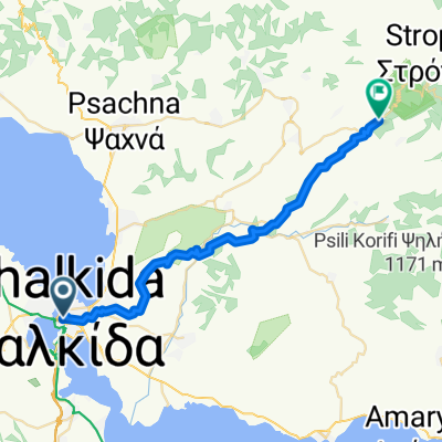
Other popular routes starting in Chalcis
 Ελευθέριου Βενιζέλου, Chalcis to Βερανζέρου, Athens
- Distance
- 90.9 km
- Ascent
- 1,606 m
- Descent
- 1,545 m
- Location
- Chalcis, Central Greece, Greece
 Brevet Chalkidas
- Distance
- 209.6 km
- Ascent
- 2,214 m
- Descent
- 2,212 m
- Location
- Chalcis, Central Greece, Greece
 251005
- Distance
- 35.4 km
- Ascent
- 145 m
- Descent
- 186 m
- Location
- Chalcis, Central Greece, Greece
 Eleftheriou Venizelou, Chalcis to Stenis-Chiliadous, Steni Dirfyos
- Distance
- 33.8 km
- Ascent
- 982 m
- Descent
- 610 m
- Location
- Chalcis, Central Greece, Greece
 Chalkideon to Λεωφόρος Εθνάρχου Μακάριου, Xirovrysi
- Distance
- 9.2 km
- Ascent
- 160 m
- Descent
- 153 m
- Location
- Chalcis, Central Greece, Greece
 2017_09_13_Giro del Mediterraneo - Episodio 8 - Tappa 6 - Chalkida - Nea Styra
- Distance
- 88.2 km
- Ascent
- 518 m
- Descent
- 517 m
- Location
- Chalcis, Central Greece, Greece
 02 - chalkdia stavros politika
- Distance
- 73.6 km
- Ascent
- 823 m
- Descent
- 823 m
- Location
- Chalcis, Central Greece, Greece
 Παπαστρατή 22, Χαλκίδα to Στρατηγού Ιωάννη Λειβαρά 28, Χαλκίδα
- Distance
- 21.1 km
- Ascent
- 143 m
- Descent
- 179 m
- Location
- Chalcis, Central Greece, Greece
Open it in the app