

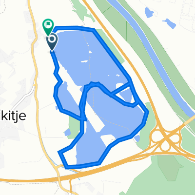
tura sava - sv.n jezera
A cycling route starting in Rakitje, Zagreb County, Croatia.
Overview
About this route
<ul>
<li>route to Svetonedeljska lakes and along the Sava river</li>
<li>recreational route</li>
<li>suitable for everyone</li>
</ul>
<p> </p>
Translated, show original (Polish)- -:--
- Duration
- 15.6 km
- Distance
- 44 m
- Ascent
- 42 m
- Descent
- ---
- Avg. speed
- ---
- Max. altitude

Route quality
Waytypes & surfaces along the route
Waytypes
Track
12.3 km
(79 %)
Access road
1.9 km
(12 %)
Surfaces
Paved
0.5 km
(3 %)
Unpaved
13.4 km
(86 %)
Gravel
11.2 km
(72 %)
Ground
2 km
(13 %)
Continue with Bikemap
Use, edit, or download this cycling route
You would like to ride tura sava - sv.n jezera or customize it for your own trip? Here is what you can do with this Bikemap route:
Free features
- Save this route as favorite or in collections
- Copy & plan your own version of this route
- Sync your route with Garmin or Wahoo
Premium features
Free trial for 3 days, or one-time payment. More about Bikemap Premium.
- Navigate this route on iOS & Android
- Export a GPX / KML file of this route
- Create your custom printout (try it for free)
- Download this route for offline navigation
Discover more Premium features.
Get Bikemap PremiumFrom our community
Other popular routes starting in Rakitje
 Rakitje-skela-Jarun-Arena
- Distance
- 54.1 km
- Ascent
- 43 m
- Descent
- 43 m
- Location
- Rakitje, Zagreb County, Croatia
 Žugci ulica 7, Novaki to Ulica Jurja Barakovića 9, Zagreb
- Distance
- 10.5 km
- Ascent
- 253 m
- Descent
- 281 m
- Location
- Rakitje, Zagreb County, Croatia
 Sveta Nedelja - ruta Sava - SV.Ned.jezera
- Distance
- 15.6 km
- Ascent
- 23 m
- Descent
- 20 m
- Location
- Rakitje, Zagreb County, Croatia
 Jezerska ulica 6, Rakitje to Ulica Frane Petrića 1, Zagreb
- Distance
- 14.9 km
- Ascent
- 43 m
- Descent
- 26 m
- Location
- Rakitje, Zagreb County, Croatia
 tura sava - sv.n jezera
- Distance
- 15.6 km
- Ascent
- 44 m
- Descent
- 42 m
- Location
- Rakitje, Zagreb County, Croatia
 4V - Da ZAGABRIA a HARVATSKA KOSTAJNICA
- Distance
- 127.9 km
- Ascent
- 239 m
- Descent
- 250 m
- Location
- Rakitje, Zagreb County, Croatia
 Zagreb to Magdeburg
- Distance
- 1,215.6 km
- Ascent
- 1,614 m
- Descent
- 1,686 m
- Location
- Rakitje, Zagreb County, Croatia
 rakitje
- Distance
- 8.4 km
- Ascent
- 26 m
- Descent
- 20 m
- Location
- Rakitje, Zagreb County, Croatia
Open it in the app