
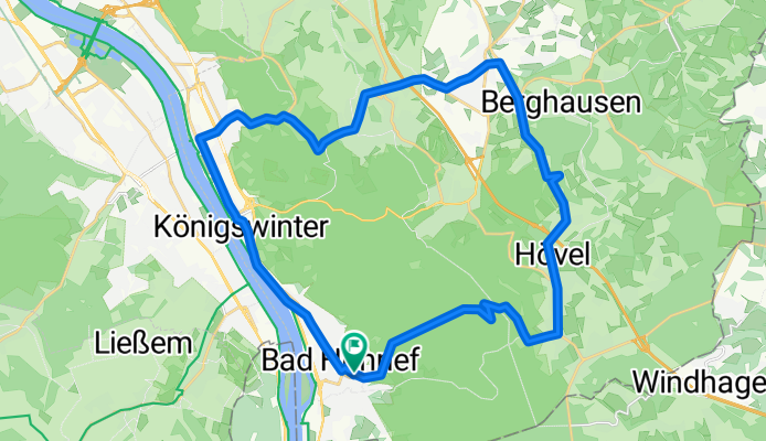
Bad Honnef - Aegidienberg- Oberpleis und Heisterbacherrott
A cycling route starting in Bad Honnef, North Rhine-Westphalia, Germany.
Overview
About this route
Ab Aegiedienberg eher flach und Berg ab!
- -:--
- Duration
- 30.7 km
- Distance
- 353 m
- Ascent
- 353 m
- Descent
- ---
- Avg. speed
- ---
- Max. altitude
Continue with Bikemap
Use, edit, or download this cycling route
You would like to ride Bad Honnef - Aegidienberg- Oberpleis und Heisterbacherrott or customize it for your own trip? Here is what you can do with this Bikemap route:
Free features
- Save this route as favorite or in collections
- Copy & plan your own version of this route
- Sync your route with Garmin or Wahoo
Premium features
Free trial for 3 days, or one-time payment. More about Bikemap Premium.
- Navigate this route on iOS & Android
- Export a GPX / KML file of this route
- Create your custom printout (try it for free)
- Download this route for offline navigation
Discover more Premium features.
Get Bikemap PremiumFrom our community
Other popular routes starting in Bad Honnef
 Rhöndorf-Bad Honnef (W)
- Distance
- 13.2 km
- Ascent
- 472 m
- Descent
- 473 m
- Location
- Bad Honnef, North Rhine-Westphalia, Germany
 7 Berge
- Distance
- 35.2 km
- Ascent
- 763 m
- Descent
- 763 m
- Location
- Bad Honnef, North Rhine-Westphalia, Germany
 Siebengebirgstrail !!! 39km - 1300hm
- Distance
- 39 km
- Ascent
- 761 m
- Descent
- 765 m
- Location
- Bad Honnef, North Rhine-Westphalia, Germany
 Ittenbach - Asberg
- Distance
- 17.7 km
- Ascent
- 341 m
- Descent
- 272 m
- Location
- Bad Honnef, North Rhine-Westphalia, Germany
 Honnef-Bonn-Sieg-Honnef
- Distance
- 43.3 km
- Ascent
- 28 m
- Descent
- 29 m
- Location
- Bad Honnef, North Rhine-Westphalia, Germany
 Sieben auf einen Streich
- Distance
- 17.1 km
- Ascent
- 615 m
- Descent
- 613 m
- Location
- Bad Honnef, North Rhine-Westphalia, Germany
 Deine Mudda fährt hier lang
- Distance
- 10.2 km
- Ascent
- 352 m
- Descent
- 348 m
- Location
- Bad Honnef, North Rhine-Westphalia, Germany
 Mittlere Runde Bonn
- Distance
- 21.9 km
- Ascent
- 80 m
- Descent
- 82 m
- Location
- Bad Honnef, North Rhine-Westphalia, Germany
Open it in the app