Balade flamande
- 12.2 km
- 38 m
- 35 m
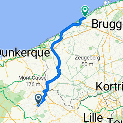
- Hazebrouck, Hauts-de-France, France
A cycling route starting in Hazebrouck, Hauts-de-France, France.
Overview
created this 3 years ago
Route quality
Quiet road
4.1 km
81 %
Track
0.5 km
10 %
Paved
3.1 km
(61 %)
Unpaved
0.4 km
(8 %)
Asphalt
3 km
59 %
Ground
0.4 km
8 %
Continue with Bikemap
You would like to ride De Grand Chemin de Cassel 74, Hazebrouck à Route sans nom, Wallon-Cappel or customize it for your own trip? Here is what you can do with this Bikemap route:
Free trial for 3 days, or one-time payment. More about Bikemap Premium.
Discover more Premium features.
Get Bikemap PremiumFrom our community
Open it in the app