

Overview
About this route
- -:--
- Duration
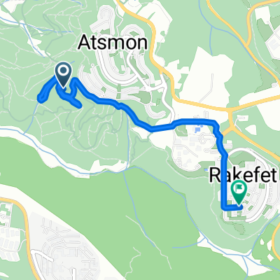
- 35.8 km
- Distance
- 678 m
- Ascent
- 773 m
- Descent
- ---
- Avg. speed
- 459 m
- Max. altitude

Part of
Segev
1 stage
Route quality
Waytypes & surfaces along the route
Waytypes
Track
21.5 km
(60 %)
Quiet road
5 km
(14 %)
Surfaces
Paved
2.5 km
(7 %)
Unpaved
3.2 km
(9 %)
Asphalt
2.1 km
(6 %)
Ground
1.4 km
(4 %)
Continue with Bikemap
Use, edit, or download this cycling route
You would like to ride Atzmon - Timrat or customize it for your own trip? Here is what you can do with this Bikemap route:
Free features
- Save this route as favorite or in collections
- Copy & plan your own version of this route
- Sync your route with Garmin or Wahoo
Premium features
Free trial for 3 days, or one-time payment. More about Bikemap Premium.
- Navigate this route on iOS & Android
- Export a GPX / KML file of this route
- Create your custom printout (try it for free)
- Download this route for offline navigation
Discover more Premium features.
Get Bikemap PremiumFrom our community
Other popular routes starting in Kabul
 От כביש 805 до כביש 805
- Distance
- 14.7 km
- Ascent
- 885 m
- Descent
- 877 m
- Location
- Kabul, Northern District, Israel
 Steady ride
- Distance
- 5 km
- Ascent
- 140 m
- Descent
- 107 m
- Location
- Kabul, Northern District, Israel
 Restful route in Shechaniya
- Distance
- 4.8 km
- Ascent
- 341 m
- Descent
- 16 m
- Location
- Kabul, Northern District, Israel
 יעד יודפת
- Distance
- 9.9 km
- Ascent
- 404 m
- Descent
- 214 m
- Location
- Kabul, Northern District, Israel
 bike tour from (null) to (null)
- Distance
- 14.4 km
- Ascent
- 390 m
- Descent
- 390 m
- Location
- Kabul, Northern District, Israel
 ride from (null) to (null)
- Distance
- 18.2 km
- Ascent
- 334 m
- Descent
- 338 m
- Location
- Kabul, Northern District, Israel
 דרך האנפה 277, עצמון שגב to דרך ללא שם, מצפה רמון
- Distance
- 402.2 km
- Ascent
- 4,524 m
- Descent
- 4,013 m
- Location
- Kabul, Northern District, Israel
 Atzmon - Timrat
- Distance
- 35.8 km
- Ascent
- 678 m
- Descent
- 773 m
- Location
- Kabul, Northern District, Israel
Open it in the app