

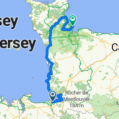
Le Havre La Rochelle #6
A cycling route starting in Pontorson, Normandy, France.
Overview
About this route
- -:--
- Duration
- 67.7 km
- Distance
- 430 m
- Ascent
- 373 m
- Descent
- ---
- Avg. speed
- 102 m
- Max. altitude

Route quality
Waytypes & surfaces along the route
Waytypes
Road
21 km
(31 %)
Quiet road
15.6 km
(23 %)
Surfaces
Paved
24.4 km
(36 %)
Unpaved
21 km
(31 %)
Asphalt
24.4 km
(36 %)
Gravel
11.5 km
(17 %)
Route highlights
Points of interest along the route
Accommodation after 0 km
Camping du havre de Regnéville
Accommodation after 0 km
Camping Picard
Accommodation after 0 km
Aire de Camping Car Beauvoir - Mont Saint-Michelin
Accommodation after 0.2 km
Oasis Camping
Accommodation after 0.2 km
Nuit #1 Camping
Accommodation after 67.7 km
Camping Gayeulles
Continue with Bikemap
Use, edit, or download this cycling route
You would like to ride Le Havre La Rochelle #6 or customize it for your own trip? Here is what you can do with this Bikemap route:
Free features
- Save this route as favorite or in collections
- Copy & plan your own version of this route
- Sync your route with Garmin or Wahoo
Premium features
Free trial for 3 days, or one-time payment. More about Bikemap Premium.
- Navigate this route on iOS & Android
- Export a GPX / KML file of this route
- Create your custom printout (try it for free)
- Download this route for offline navigation
Discover more Premium features.
Get Bikemap PremiumFrom our community
Other popular routes starting in Pontorson
 De 16bis La Caserne, Beauvoir à 11–17 Rue de la Grève, Pontaubault
- Distance
- 15.1 km
- Ascent
- 0 m
- Descent
- 11 m
- Location
- Pontorson, Normandy, France
 voyage bretagne
- Distance
- 42.2 km
- Ascent
- 56 m
- Descent
- 14 m
- Location
- Pontorson, Normandy, France
 3 Place de la Gare, Pontorson to 37 Rue du Port, Cancale
- Distance
- 53.5 km
- Ascent
- 106 m
- Descent
- 82 m
- Location
- Pontorson, Normandy, France
 Tour de France 2016 - Stage 1
- Distance
- 190.7 km
- Ascent
- 443 m
- Descent
- 445 m
- Location
- Pontorson, Normandy, France
 Pontorson - Ducey-Les Chéris
- Distance
- 29.4 km
- Ascent
- 56 m
- Descent
- 61 m
- Location
- Pontorson, Normandy, France
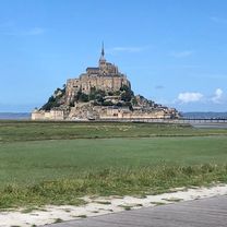
 Mont Saint Michel
- Distance
- 15.6 km
- Ascent
- 54 m
- Descent
- 56 m
- Location
- Pontorson, Normandy, France
 16/05 Bretagnetour
- Distance
- 46.6 km
- Ascent
- 58 m
- Descent
- 48 m
- Location
- Pontorson, Normandy, France
 Route to Le Grand Enclos Ardevon, 50170 Pontorson
- Distance
- 7.5 km
- Ascent
- 0 m
- Descent
- 0 m
- Location
- Pontorson, Normandy, France
Open it in the app