

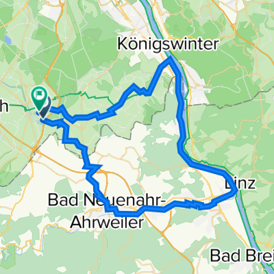
Rheintal: Wine, Rhine and Romans
A cycling route starting in Meckenheim, North Rhine-Westphalia, Germany.
Overview
About this route
GravelRoute - Einstieg überall möglich
- -:--
- Duration
- 266.2 km
- Distance
- 6,602 m
- Ascent
- 6,603 m
- Descent
- ---
- Avg. speed
- 716 m
- Max. altitude

Route quality
Waytypes & surfaces along the route
Waytypes
Track
157.1 km
(59 %)
Quiet road
34.6 km
(13 %)
Surfaces
Paved
101.2 km
(38 %)
Unpaved
125.1 km
(47 %)
Asphalt
93.2 km
(35 %)
Gravel
53.2 km
(20 %)
Continue with Bikemap
Use, edit, or download this cycling route
You would like to ride Rheintal: Wine, Rhine and Romans or customize it for your own trip? Here is what you can do with this Bikemap route:
Free features
- Save this route as favorite or in collections
- Copy & plan your own version of this route
- Split it into stages to create a multi-day tour
- Sync your route with Garmin or Wahoo
Premium features
Free trial for 3 days, or one-time payment. More about Bikemap Premium.
- Navigate this route on iOS & Android
- Export a GPX / KML file of this route
- Create your custom printout (try it for free)
- Download this route for offline navigation
Discover more Premium features.
Get Bikemap PremiumFrom our community
Other popular routes starting in Meckenheim
 Tomburg
- Distance
- 9.7 km
- Ascent
- 119 m
- Descent
- 21 m
- Location
- Meckenheim, North Rhine-Westphalia, Germany
 Am Rebstock 11, Meckenheim nach Am Rebstock 22, Meckenheim
- Distance
- 14.2 km
- Ascent
- 86 m
- Descent
- 95 m
- Location
- Meckenheim, North Rhine-Westphalia, Germany
 Kottenforst-Ville
- Distance
- 62.3 km
- Ascent
- 106 m
- Descent
- 227 m
- Location
- Meckenheim, North Rhine-Westphalia, Germany
 Small round south of Bonn, Germany
- Distance
- 58.4 km
- Ascent
- 300 m
- Descent
- 290 m
- Location
- Meckenheim, North Rhine-Westphalia, Germany
 Dechant-Kreiten-Straße 14, Meckenheim nach Keramikerstraße 61, Rheinbach
- Distance
- 6.5 km
- Ascent
- 18 m
- Descent
- 20 m
- Location
- Meckenheim, North Rhine-Westphalia, Germany
 Kottenforst-Runde
- Distance
- 18.5 km
- Ascent
- 104 m
- Descent
- 104 m
- Location
- Meckenheim, North Rhine-Westphalia, Germany
 Rheintal: Wine, Rhine and Romans
- Distance
- 266.2 km
- Ascent
- 6,602 m
- Descent
- 6,603 m
- Location
- Meckenheim, North Rhine-Westphalia, Germany
 Rund um Rheinbach, Ahr und Eifel
- Distance
- 62.6 km
- Ascent
- 440 m
- Descent
- 440 m
- Location
- Meckenheim, North Rhine-Westphalia, Germany
Open it in the app