

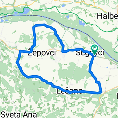
RKM 2011
A cycling route starting in Apače, Občina Apače, Slovenia.
Overview
About this route
- -:--
- Duration
- 26.2 km
- Distance
- 140 m
- Ascent
- 140 m
- Descent
- ---
- Avg. speed
- ---
- Max. altitude
Route quality
Waytypes & surfaces along the route
Waytypes
Quiet road
20.4 km
(78 %)
Access road
5 km
(19 %)
Surfaces
Paved
24.9 km
(95 %)
Unpaved
1 km
(4 %)
Asphalt
24.9 km
(95 %)
Gravel
1 km
(4 %)
Undefined
0.3 km
(1 %)
Route highlights
Points of interest along the route
Point of interest after 11.9 km
KT Marko Nasova
Point of interest after 18.7 km
Steyer Plitvica
Continue with Bikemap
Use, edit, or download this cycling route
You would like to ride RKM 2011 or customize it for your own trip? Here is what you can do with this Bikemap route:
Free features
- Save this route as favorite or in collections
- Copy & plan your own version of this route
- Sync your route with Garmin or Wahoo
Premium features
Free trial for 3 days, or one-time payment. More about Bikemap Premium.
- Navigate this route on iOS & Android
- Export a GPX / KML file of this route
- Create your custom printout (try it for free)
- Download this route for offline navigation
Discover more Premium features.
Get Bikemap PremiumFrom our community
Other popular routes starting in Apače
 Črnci nach Klöch
- Distance
- 19.2 km
- Ascent
- 127 m
- Descent
- 73 m
- Location
- Apače, Občina Apače, Slovenia
 Segovci 34b to Segovci 34a
- Distance
- 25.6 km
- Ascent
- 100 m
- Descent
- 136 m
- Location
- Apače, Občina Apače, Slovenia
 Draft Route
- Distance
- 5.1 km
- Ascent
- 992 m
- Descent
- 981 m
- Location
- Apače, Občina Apače, Slovenia
 RKM 2011
- Distance
- 26.2 km
- Ascent
- 140 m
- Descent
- 140 m
- Location
- Apače, Občina Apače, Slovenia
 Črnci 63 to Donnersdorf 246
- Distance
- 3.1 km
- Ascent
- 0 m
- Descent
- 46 m
- Location
- Apače, Občina Apače, Slovenia
 Vodnik - Apace, ob Muri
- Distance
- 24.9 km
- Ascent
- 27 m
- Descent
- 26 m
- Location
- Apače, Občina Apače, Slovenia
 Konjišče-Trate
- Distance
- 15.7 km
- Ascent
- 183 m
- Descent
- 181 m
- Location
- Apače, Občina Apače, Slovenia
 Segovci 34b to Segovci 34b
- Distance
- 22.4 km
- Ascent
- 107 m
- Descent
- 114 m
- Location
- Apače, Občina Apače, Slovenia
Open it in the app