

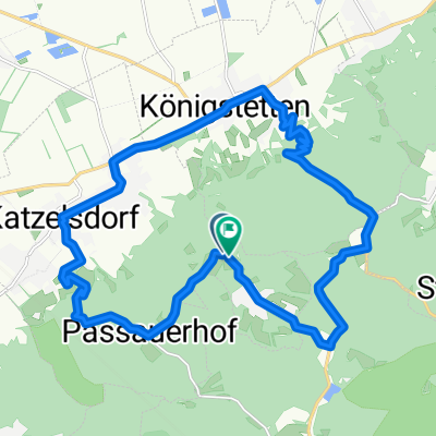
3-Tagestour April 2023
Wilfersdorf - Hollabrunn - Laa/Thaya
A cycling route starting in Tulbing, Lower Austria, Austria.
Overview
About this route
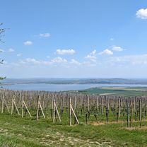
Einige Gravelabschnitte zwischen Hollabrunn und Laa.
- -:--
- Duration
- 85.1 km
- Distance
- 520 m
- Ascent
- 561 m
- Descent
- ---
- Avg. speed
- 368 m
- Max. altitude

Part of
3-Tagestour April 2023
3 stages
Route quality
Waytypes & surfaces along the route
Waytypes
Road
32.9 km
(39 %)
Busy road
18.4 km
(22 %)
Surfaces
Paved
37.9 km
(45 %)
Unpaved
3.5 km
(4 %)
Asphalt
35.3 km
(41 %)
Gravel
2.6 km
(3 %)
Continue with Bikemap
Use, edit, or download this cycling route
You would like to ride Wilfersdorf - Hollabrunn - Laa/Thaya or customize it for your own trip? Here is what you can do with this Bikemap route:
Free features
- Save this route as favorite or in collections
- Copy & plan your own version of this route
- Split it into stages to create a multi-day tour
- Sync your route with Garmin or Wahoo
Premium features
Free trial for 3 days, or one-time payment. More about Bikemap Premium.
- Navigate this route on iOS & Android
- Export a GPX / KML file of this route
- Create your custom printout (try it for free)
- Download this route for offline navigation
Discover more Premium features.
Get Bikemap PremiumFrom our community
Other popular routes starting in Tulbing
 Wilfersdorf - Hollabrunn - Laa/Thaya
- Distance
- 85.1 km
- Ascent
- 520 m
- Descent
- 561 m
- Location
- Tulbing, Lower Austria, Austria
 Tulbing-Kogl-Hintersdorf- Steinriegl-Weidlingbach- Mauerbach-Wilfersdorf-Tulbing
- Distance
- 31 km
- Ascent
- 472 m
- Descent
- 448 m
- Location
- Tulbing, Lower Austria, Austria
 Heimrunde
- Distance
- 16.8 km
- Ascent
- 555 m
- Descent
- 532 m
- Location
- Tulbing, Lower Austria, Austria
 MTB durch den nahen Wienerwald und an der Donau zurück
- Distance
- 67.2 km
- Ascent
- 771 m
- Descent
- 771 m
- Location
- Tulbing, Lower Austria, Austria
 Etappe16
- Distance
- 26 km
- Ascent
- 215 m
- Descent
- 325 m
- Location
- Tulbing, Lower Austria, Austria
 Tulbinger-Kogel-Runde
- Distance
- 20.8 km
- Ascent
- 394 m
- Descent
- 392 m
- Location
- Tulbing, Lower Austria, Austria
 Wolfpassing1
- Distance
- 15.1 km
- Ascent
- 38 m
- Descent
- 266 m
- Location
- Tulbing, Lower Austria, Austria
 Trainingsrunde 21.04.2014
- Distance
- 25.6 km
- Ascent
- 52 m
- Descent
- 52 m
- Location
- Tulbing, Lower Austria, Austria
Open it in the app