

Iller,Donau,Tauber,Main
UT 03-2023: Altusried - Ulm
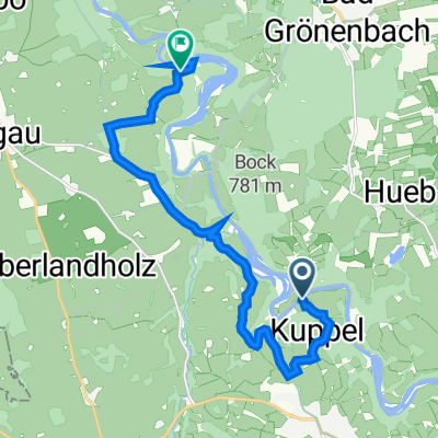
A cycling route starting in Altusried, Bavaria, Germany.
Overview
About this route
- -:--
- Duration
- 84.5 km
- Distance
- 383 m
- Ascent
- 629 m
- Descent
- ---
- Avg. speed
- 740 m
- Max. altitude

Part of
13 stages
Route quality
Waytypes & surfaces along the route
Waytypes
Track
46.5 km
(55 %)
Quiet road
23.7 km
(28 %)
Surfaces
Paved
19.4 km
(23 %)
Unpaved
49 km
(58 %)
Gravel
36.3 km
(43 %)
Asphalt
16.1 km
(19 %)
Route highlights
Points of interest along the route
Accommodation after 0 km
Ferienwohnung HAUS SONNENECK - 01.-04.07. Am Jürgenfeld 20, 87645 Schwangau
Accommodation after 0 km
Gasthaus Sonne Altusried 05.-06.07. Kirchstraße 7, 87452 Altusried
Point of interest after 0.1 km
Brunnen
Point of interest after 2.4 km
Burg Kalden
Point of interest after 5.3 km
Fischtreppe
Point of interest after 16.4 km
Historische Eisenbahnbrücke Illerbeuren
Bike service after 17.1 km
Ladestation
Point of interest after 17.2 km
Schwäbisches Bauernhofmuseum Illerbeuren
Point of interest after 22.3 km
Tulpenbaumallee Ferthofen
Point of interest after 22.7 km
Obelisk Ferthofen
Bike service after 23.5 km
Ladestation
Point of interest after 32.2 km
Iller Staustufe
Point of interest after 35.4 km
ßIller Staustufe
Accommodation after 63.9 km
Hotel Zur Glocke 07.-08.07. Friedrich-von-Teck-Straße 12, 89420 Höchstädt an der Donau
Point of interest after 68 km
Chill Point
Point of interest after 68.2 km
Brunnen Leipheim
Point of interest after 80.1 km
Illermündung
Point of interest after 82.3 km
Blaumündung/Kobelgraben
Accommodation after 83.4 km
Prinzhotel Rothenburg 09.-10.07. Hofstatt 3, 91541 Rothenburg ob der Tauber
Accommodation after 83.4 km
Cafe-Hotel Altreuter 08.-09.07. 11 Marktplatz, Nördlingen, 86720
Accommodation after 83.4 km
Hotel Neuthor 06.-07.07. Neuer Graben 17, 89073 Ulm
Accommodation after 83.4 km
Hotel Schmuckkästchen 11.-12.07. Hauptstraße 185, 63897 Miltenberg
Point of interest after 84 km
Ulmer Münster
Point of interest after 84.3 km
Altstadt
Point of interest after 84.5 km
Blaumündung/Kobelgraben
Continue with Bikemap
Use, edit, or download this cycling route
You would like to ride UT 03-2023: Altusried - Ulm or customize it for your own trip? Here is what you can do with this Bikemap route:
Free features
- Save this route as favorite or in collections
- Copy & plan your own version of this route
- Split it into stages to create a multi-day tour
- Sync your route with Garmin or Wahoo
Premium features
Free trial for 3 days, or one-time payment. More about Bikemap Premium.
- Navigate this route on iOS & Android
- Export a GPX / KML file of this route
- Create your custom printout (try it for free)
- Download this route for offline navigation
Discover more Premium features.
Get Bikemap PremiumFrom our community
Other popular routes starting in Altusried
 Altusried - Oberschwaben 117 km
- Distance
- 109.2 km
- Ascent
- 513 m
- Descent
- 566 m
- Location
- Altusried, Bavaria, Germany
 UT 03-2023: Altusried - Ulm
- Distance
- 84.5 km
- Ascent
- 383 m
- Descent
- 629 m
- Location
- Altusried, Bavaria, Germany
 MTB Altusried-Leutkirch
- Distance
- 31.5 km
- Ascent
- 360 m
- Descent
- 432 m
- Location
- Altusried, Bavaria, Germany
 Fischers 5, Altusried nach Legau
- Distance
- 13.5 km
- Ascent
- 304 m
- Descent
- 276 m
- Location
- Altusried, Bavaria, Germany
 Iller 3
- Distance
- 55.9 km
- Ascent
- 152 m
- Descent
- 153 m
- Location
- Altusried, Bavaria, Germany
 AltusriedRunde
- Distance
- 46.3 km
- Ascent
- 530 m
- Descent
- 530 m
- Location
- Altusried, Bavaria, Germany
 Altusried-Unterthingau-Isny-Altusried
- Distance
- 107 km
- Ascent
- 752 m
- Descent
- 757 m
- Location
- Altusried, Bavaria, Germany
 Unterkürnach
- Distance
- 26.4 km
- Ascent
- 588 m
- Descent
- 528 m
- Location
- Altusried, Bavaria, Germany
Open it in the app