

Iller,Donau,Tauber,Main
UT 07-2023: Rothenburg o.d.T - TauberBischofsheim
A cycling route starting in Rothenburg upon Tauber, Bavaria, Germany.
Overview
About this route
- -:--
- Duration
- 70.6 km
- Distance
- 287 m
- Ascent
- 527 m
- Descent
- ---
- Avg. speed
- 431 m
- Max. altitude

Part of
Iller,Donau,Tauber,Main
13 stages
Route quality
Waytypes & surfaces along the route
Waytypes
Track
36 km
(51 %)
Quiet road
21.2 km
(30 %)
Surfaces
Paved
62.8 km
(89 %)
Asphalt
59.3 km
(84 %)
Paved (undefined)
3.5 km
(5 %)
Undefined
7.8 km
(11 %)
Route highlights
Points of interest along the route
Accommodation after 0 km
Prinzhotel Rothenburg 09.-10.07. Hofstatt 3, 91541 Rothenburg ob der Tauber
Accommodation after 70.6 km
Badischer Hof 10.-11.07. Hauptstrasse 70, 97941 Tauberbischofsheim
Continue with Bikemap
Use, edit, or download this cycling route
You would like to ride UT 07-2023: Rothenburg o.d.T - TauberBischofsheim or customize it for your own trip? Here is what you can do with this Bikemap route:
Free features
- Save this route as favorite or in collections
- Copy & plan your own version of this route
- Sync your route with Garmin or Wahoo
Premium features
Free trial for 3 days, or one-time payment. More about Bikemap Premium.
- Navigate this route on iOS & Android
- Export a GPX / KML file of this route
- Create your custom printout (try it for free)
- Download this route for offline navigation
Discover more Premium features.
Get Bikemap PremiumFrom our community
Other popular routes starting in Rothenburg upon Tauber
 Abendrunde über die Frankenhöhe
- Distance
- 18.2 km
- Ascent
- 146 m
- Descent
- 170 m
- Location
- Rothenburg upon Tauber, Bavaria, Germany
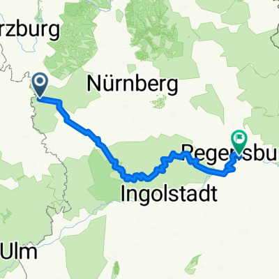 Rothenburg-Regensburg
- Distance
- 263.4 km
- Ascent
- 1,292 m
- Descent
- 1,373 m
- Location
- Rothenburg upon Tauber, Bavaria, Germany
 Rothenburg to Bamberg
- Distance
- 120.8 km
- Ascent
- 98 m
- Descent
- 285 m
- Location
- Rothenburg upon Tauber, Bavaria, Germany
 Altmühlradweg: Rothenburg-Kelheim
- Distance
- 244.8 km
- Ascent
- 316 m
- Descent
- 400 m
- Location
- Rothenburg upon Tauber, Bavaria, Germany
 Taubertal-Panorama
- Distance
- 52.4 km
- Ascent
- 733 m
- Descent
- 895 m
- Location
- Rothenburg upon Tauber, Bavaria, Germany
 Rothenburg Burgbernheim Runde
- Distance
- 30.5 km
- Ascent
- 266 m
- Descent
- 275 m
- Location
- Rothenburg upon Tauber, Bavaria, Germany
 altmühltal
- Distance
- 137.4 km
- Ascent
- 496 m
- Descent
- 540 m
- Location
- Rothenburg upon Tauber, Bavaria, Germany
 Paneuropa radweg (alternative german part)
- Distance
- 36 km
- Ascent
- 498 m
- Descent
- 580 m
- Location
- Rothenburg upon Tauber, Bavaria, Germany
Open it in the app