

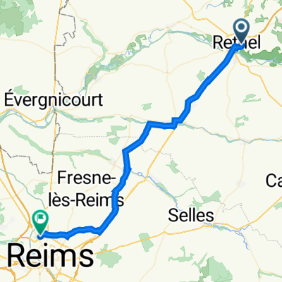
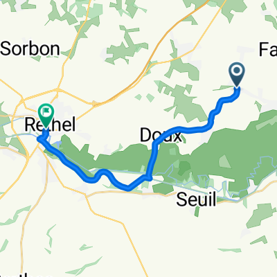
Overview
About this route
- -:--
- Duration
- 43.9 km
- Distance
- 224 m
- Ascent
- 221 m
- Descent
- ---
- Avg. speed
- 141 m
- Max. altitude

Part of
Pariisi
12 stages
Route quality
Waytypes & surfaces along the route
Waytypes
Road
20.2 km
(46 %)
Quiet road
17.6 km
(40 %)
Surfaces
Paved
12.7 km
(29 %)
Asphalt
12.7 km
(29 %)
Undefined
31.2 km
(71 %)
Continue with Bikemap
Use, edit, or download this cycling route
You would like to ride 09 Reims or customize it for your own trip? Here is what you can do with this Bikemap route:
Free features
- Save this route as favorite or in collections
- Copy & plan your own version of this route
- Sync your route with Garmin or Wahoo
Premium features
Free trial for 3 days, or one-time payment. More about Bikemap Premium.
- Navigate this route on iOS & Android
- Export a GPX / KML file of this route
- Create your custom printout (try it for free)
- Download this route for offline navigation
Discover more Premium features.
Get Bikemap PremiumFrom our community
Other popular routes starting in Rethel
 10km
10km- Distance
- 9.6 km
- Ascent
- 151 m
- Descent
- 111 m
- Location
- Rethel, Grand Est, France
 Joinville 1987
- Distance
- 167.2 km
- Ascent
- 619 m
- Descent
- 517 m
- Location
- Rethel, Grand Est, France
 28KM Wasigny
- Distance
- 28.8 km
- Ascent
- 328 m
- Descent
- 341 m
- Location
- Rethel, Grand Est, France
 09 Reims
- Distance
- 43.9 km
- Ascent
- 224 m
- Descent
- 221 m
- Location
- Rethel, Grand Est, France
 35KM Wasigny
- Distance
- 35.9 km
- Ascent
- 198 m
- Descent
- 209 m
- Location
- Rethel, Grand Est, France
 Place de la Gare, Lucquy nach Place de la République, Rethel
- Distance
- 13.3 km
- Ascent
- 64 m
- Descent
- 68 m
- Location
- Rethel, Grand Est, France
 1.rethel-rethel
- Distance
- 182.7 km
- Ascent
- 638 m
- Descent
- 638 m
- Location
- Rethel, Grand Est, France
 43KM Landschap Wasigny
- Distance
- 43.3 km
- Ascent
- 402 m
- Descent
- 409 m
- Location
- Rethel, Grand Est, France
Open it in the app