

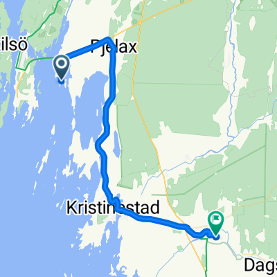
0046 EuroVelo 10 Day 29
A cycling route starting in Kaskinen, Ostrobothnia, Finland.
Overview
About this route
Ridden by Stig 09.06.2011.
Actual distance 102,7 km
- -:--
- Duration
- 97.9 km
- Distance
- 0 m
- Ascent
- 0 m
- Descent
- ---
- Avg. speed
- ---
- Max. altitude

Route quality
Waytypes & surfaces along the route
Waytypes
Road
59.7 km
(61 %)
Cycleway
16.6 km
(17 %)
Surfaces
Paved
49.9 km
(51 %)
Asphalt
37.2 km
(38 %)
Paved (undefined)
12.7 km
(13 %)
Undefined
48 km
(49 %)
Continue with Bikemap
Use, edit, or download this cycling route
You would like to ride 0046 EuroVelo 10 Day 29 or customize it for your own trip? Here is what you can do with this Bikemap route:
Free features
- Save this route as favorite or in collections
- Copy & plan your own version of this route
- Split it into stages to create a multi-day tour
- Sync your route with Garmin or Wahoo
Premium features
Free trial for 3 days, or one-time payment. More about Bikemap Premium.
- Navigate this route on iOS & Android
- Export a GPX / KML file of this route
- Create your custom printout (try it for free)
- Download this route for offline navigation
Discover more Premium features.
Get Bikemap PremiumFrom our community
Other popular routes starting in Kaskinen
 Kuningas Kustaan aukio 1–3, Kaskinen to Vaasanpuistikko, Vaasa
- Distance
- 98.7 km
- Ascent
- 70 m
- Descent
- 70 m
- Location
- Kaskinen, Ostrobothnia, Finland
 Finnslättvägen 25, Pjelax to Skrattnäsvägen 1235–1247, Pjelax
- Distance
- 1.1 km
- Ascent
- 26 m
- Descent
- 29 m
- Location
- Kaskinen, Ostrobothnia, Finland
 0046 EuroVelo 10 Day 29
- Distance
- 97.9 km
- Ascent
- 0 m
- Descent
- 0 m
- Location
- Kaskinen, Ostrobothnia, Finland
 Kirkkokatu, Kaskinen to Kauppapuistikko 13, Vaasa
- Distance
- 105.5 km
- Ascent
- 224 m
- Descent
- 221 m
- Location
- Kaskinen, Ostrobothnia, Finland
 Kaldnäs bodväg 1–27, Pjelax to Kaskövägen 281, Närpiö
- Distance
- 13 km
- Ascent
- 0 m
- Descent
- 9 m
- Location
- Kaskinen, Ostrobothnia, Finland
 Högskärsvägen 64–68, Pjelax to Knusinkuja 58, Lapväärtti
- Distance
- 31 km
- Ascent
- 10 m
- Descent
- 20 m
- Location
- Kaskinen, Ostrobothnia, Finland
 Högskärsvägen 64–68, Pjelax to Högskärsvägen 64–68, Pjelax
- Distance
- 17.7 km
- Ascent
- 0 m
- Descent
- 4 m
- Location
- Kaskinen, Ostrobothnia, Finland
 Leirintäalueentie, Kaskinen à Ämttööntie 21, Ahlainen
- Distance
- 118.4 km
- Ascent
- 237 m
- Descent
- 234 m
- Location
- Kaskinen, Ostrobothnia, Finland
Open it in the app