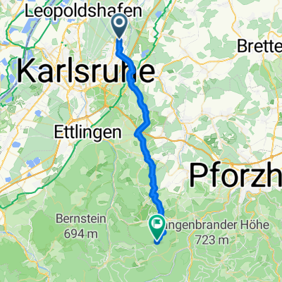
Untergrombach über Augsteiner nach Unteröwisheim- Stettfeld und zurück
A cycling route starting in Weingarten, Baden-Wurttemberg, Germany.
Overview
About this route
- -:--
- Duration
- 26.3 km
- Distance
- 182 m
- Ascent
- 181 m
- Descent
- ---
- Avg. speed
- 229 m
- Max. altitude
Route quality
Waytypes & surfaces along the route
Waytypes
Quiet road
8.1 km
(31 %)
Track
6 km
(23 %)
Surfaces
Paved
20.2 km
(77 %)
Unpaved
2.1 km
(8 %)
Asphalt
18.4 km
(70 %)
Paved (undefined)
1.8 km
(7 %)
Route highlights
Points of interest along the route
Point of interest after 0 km
Start
Continue with Bikemap
Use, edit, or download this cycling route
You would like to ride Untergrombach über Augsteiner nach Unteröwisheim- Stettfeld und zurück or customize it for your own trip? Here is what you can do with this Bikemap route:
Free features
- Save this route as favorite or in collections
- Copy & plan your own version of this route
- Sync your route with Garmin or Wahoo
Premium features
Free trial for 3 days, or one-time payment. More about Bikemap Premium.
- Navigate this route on iOS & Android
- Export a GPX / KML file of this route
- Create your custom printout (try it for free)
- Download this route for offline navigation
Discover more Premium features.
Get Bikemap PremiumFrom our community
Other popular routes starting in Weingarten
Von Stutensee bis Straubenhardt- Distance
- 32 km
- Ascent
- 672 m
- Descent
- 240 m
- Location
- Weingarten, Baden-Wurttemberg, Germany
Tour 3- Distance
- 17.7 km
- Ascent
- 43 m
- Descent
- 43 m
- Location
- Weingarten, Baden-Wurttemberg, Germany
Feierabendrunde um Weingarten- Distance
- 26.2 km
- Ascent
- 342 m
- Descent
- 342 m
- Location
- Weingarten, Baden-Wurttemberg, Germany
Untergrombach über Augsteiner nach Unteröwisheim- Stettfeld und zurück- Distance
- 26.3 km
- Ascent
- 182 m
- Descent
- 181 m
- Location
- Weingarten, Baden-Wurttemberg, Germany
Weingarten - Sternenfels - Maulbronn - Remchingen 85- Distance
- 85 km
- Ascent
- 542 m
- Descent
- 545 m
- Location
- Weingarten, Baden-Wurttemberg, Germany
Tour de Turmberg- Distance
- 28.7 km
- Ascent
- 213 m
- Descent
- 215 m
- Location
- Weingarten, Baden-Wurttemberg, Germany
WGT-LMZ- Distance
- 14.6 km
- Ascent
- 139 m
- Descent
- 20 m
- Location
- Weingarten, Baden-Wurttemberg, Germany
Blankenloch-Rheinsheim- Distance
- 53 km
- Ascent
- 77 m
- Descent
- 78 m
- Location
- Weingarten, Baden-Wurttemberg, Germany
Open it in the app


