

Góry Świętokrzyskie - wersja długa
A cycling route starting in Zagnańsk, Świętokrzyskie Voivodship, Poland.
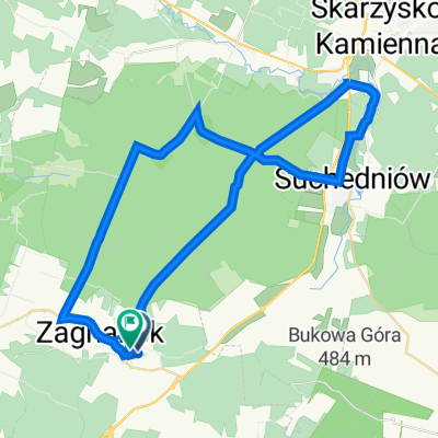
Overview
About this route
xxx
- -:--
- Duration
- 97.7 km
- Distance
- 1,248 m
- Ascent
- 1,245 m
- Descent
- ---
- Avg. speed
- 599 m
- Max. altitude

Route quality
Waytypes & surfaces along the route
Waytypes
Road
31.3 km
(32 %)
Quiet road
31.1 km
(32 %)
Surfaces
Paved
84.3 km
(86 %)
Unpaved
8 km
(8 %)
Asphalt
81 km
(83 %)
Ground
4.3 km
(4 %)
Continue with Bikemap
Use, edit, or download this cycling route
You would like to ride Góry Świętokrzyskie - wersja długa or customize it for your own trip? Here is what you can do with this Bikemap route:
Free features
- Save this route as favorite or in collections
- Copy & plan your own version of this route
- Split it into stages to create a multi-day tour
- Sync your route with Garmin or Wahoo
Premium features
Free trial for 3 days, or one-time payment. More about Bikemap Premium.
- Navigate this route on iOS & Android
- Export a GPX / KML file of this route
- Create your custom printout (try it for free)
- Download this route for offline navigation
Discover more Premium features.
Get Bikemap PremiumFrom our community
Other popular routes starting in Zagnańsk
 WISIÓWKA II
- Distance
- 15.5 km
- Ascent
- 364 m
- Descent
- 245 m
- Location
- Zagnańsk, Świętokrzyskie Voivodship, Poland
 Zalew Rejowski
- Distance
- 50.5 km
- Ascent
- 624 m
- Descent
- 623 m
- Location
- Zagnańsk, Świętokrzyskie Voivodship, Poland
 Góry Świętokrzyskie - wersja krótka
- Distance
- 52 km
- Ascent
- 538 m
- Descent
- 537 m
- Location
- Zagnańsk, Świętokrzyskie Voivodship, Poland
 odyseja zagnańska
- Distance
- 102.5 km
- Ascent
- 709 m
- Descent
- 709 m
- Location
- Zagnańsk, Świętokrzyskie Voivodship, Poland
 Sliwka Gruszka test 75km
- Distance
- 75.6 km
- Ascent
- 628 m
- Descent
- 628 m
- Location
- Zagnańsk, Świętokrzyskie Voivodship, Poland
 Zagnańsk szlaki rowerowe.net
- Distance
- 34 km
- Ascent
- 345 m
- Descent
- 344 m
- Location
- Zagnańsk, Świętokrzyskie Voivodship, Poland
 Zalew Sielpia - krótsza wersja
- Distance
- 89.3 km
- Ascent
- 845 m
- Descent
- 845 m
- Location
- Zagnańsk, Świętokrzyskie Voivodship, Poland
 2012/13 Zagnańsk - Krasna - Mokra - Szałasy
- Distance
- 69 km
- Ascent
- 474 m
- Descent
- 474 m
- Location
- Zagnańsk, Świętokrzyskie Voivodship, Poland
Open it in the app