

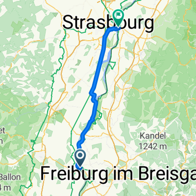
3 Breisach Kehl v2
A cycling route starting in Algolsheim, Grand Est, France.
Overview
About this route
- -:--
- Duration
- 83 km
- Distance
- 273 m
- Ascent
- 316 m
- Descent
- ---
- Avg. speed
- 194 m
- Max. altitude

Route quality
Waytypes & surfaces along the route
Waytypes
Track
65.6 km
(79 %)
Quiet road
7.5 km
(9 %)
Surfaces
Paved
20.8 km
(25 %)
Unpaved
62.3 km
(75 %)
Gravel
53.1 km
(64 %)
Asphalt
19.1 km
(23 %)
Continue with Bikemap
Use, edit, or download this cycling route
You would like to ride 3 Breisach Kehl v2 or customize it for your own trip? Here is what you can do with this Bikemap route:
Free features
- Save this route as favorite or in collections
- Copy & plan your own version of this route
- Split it into stages to create a multi-day tour
- Sync your route with Garmin or Wahoo
Premium features
Free trial for 3 days, or one-time payment. More about Bikemap Premium.
- Navigate this route on iOS & Android
- Export a GPX / KML file of this route
- Create your custom printout (try it for free)
- Download this route for offline navigation
Discover more Premium features.
Get Bikemap PremiumFrom our community
Other popular routes starting in Algolsheim
 Breisach - Kehl
- Distance
- 197.7 km
- Ascent
- 2,012 m
- Descent
- 2,061 m
- Location
- Algolsheim, Grand Est, France
 FREIBURG-BERN-CENEVRE-CHAMBERY-X-TORINO-STRADELLA-AOLA-PRATO-AREZZO-ORVETO-ROMA-VITERO-MONDONUVO-PRATO-VENEDİK-TRIESTE
- Distance
- 2,402.8 km
- Ascent
- 14,885 m
- Descent
- 14,938 m
- Location
- Algolsheim, Grand Est, France
 Breisach1
- Distance
- 55.5 km
- Ascent
- 342 m
- Descent
- 339 m
- Location
- Algolsheim, Grand Est, France
 Kaiserstuhlrunde
- Distance
- 62.7 km
- Ascent
- 267 m
- Descent
- 251 m
- Location
- Algolsheim, Grand Est, France
 #10 Hotel Breisacher Hof to Rosegarden
- Distance
- 72.7 km
- Ascent
- 32 m
- Descent
- 82 m
- Location
- Algolsheim, Grand Est, France
 D 028: Breisach - Kaiseraugst
- Distance
- 77 km
- Ascent
- 257 m
- Descent
- 189 m
- Location
- Algolsheim, Grand Est, France
 CYCLING THE RHINE: Route 18B
- Distance
- 23.7 km
- Ascent
- 43 m
- Descent
- 35 m
- Location
- Algolsheim, Grand Est, France
 CYCLING THE RHINE: Route 18B
- Distance
- 23.7 km
- Ascent
- 35 m
- Descent
- 32 m
- Location
- Algolsheim, Grand Est, France
Open it in the app