

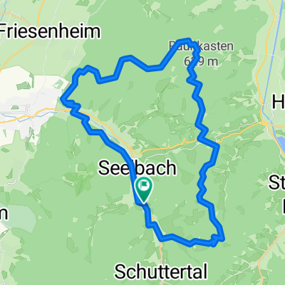
Seelbach Hirschtour
A cycling route starting in Seelbach, Baden-Wurttemberg, Germany.
Overview
About this route
Distance: 32.2 km I Elevation Gain: 620 m I Descent: 620 m I Highest Point: 573 m I Lowest Point: 190 m
- 3 h 43 min
- Duration
- 32.4 km
- Distance
- 780 m
- Ascent
- 784 m
- Descent
- 8.7 km/h
- Avg. speed
- 583 m
- Max. altitude
Route quality
Waytypes & surfaces along the route
Waytypes
Track
20.4 km
(63 %)
Quiet road
6.5 km
(20 %)
Surfaces
Paved
10.7 km
(33 %)
Unpaved
19.4 km
(60 %)
Gravel
16.8 km
(52 %)
Asphalt
8.4 km
(26 %)
Continue with Bikemap
Use, edit, or download this cycling route
You would like to ride Seelbach Hirschtour or customize it for your own trip? Here is what you can do with this Bikemap route:
Free features
- Save this route as favorite or in collections
- Copy & plan your own version of this route
- Sync your route with Garmin or Wahoo
Premium features
Free trial for 3 days, or one-time payment. More about Bikemap Premium.
- Navigate this route on iOS & Android
- Export a GPX / KML file of this route
- Create your custom printout (try it for free)
- Download this route for offline navigation
Discover more Premium features.
Get Bikemap PremiumFrom our community
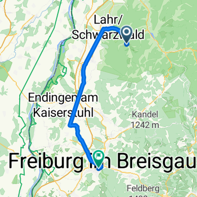
Other popular routes starting in Seelbach
 Geroldseck-Tour
- Distance
- 36.9 km
- Ascent
- 730 m
- Descent
- 730 m
- Location
- Seelbach, Baden-Wurttemberg, Germany
 geroldseck-tour
- Distance
- 46.8 km
- Ascent
- 423 m
- Descent
- 423 m
- Location
- Seelbach, Baden-Wurttemberg, Germany
 Ideen erfahren 2011 - Tag 12
- Distance
- 58.7 km
- Ascent
- 264 m
- Descent
- 205 m
- Location
- Seelbach, Baden-Wurttemberg, Germany
 Lahr - Selbach
- Distance
- 6.6 km
- Ascent
- 11 m
- Descent
- 71 m
- Location
- Seelbach, Baden-Wurttemberg, Germany
 Moderate Route in Seelbach
- Distance
- 21.5 km
- Ascent
- 449 m
- Descent
- 457 m
- Location
- Seelbach, Baden-Wurttemberg, Germany
 Geroldseck-Tour
- Distance
- 36.9 km
- Ascent
- 730 m
- Descent
- 730 m
- Location
- Seelbach, Baden-Wurttemberg, Germany
 Seelbach Hirschtour
- Distance
- 32.4 km
- Ascent
- 780 m
- Descent
- 784 m
- Location
- Seelbach, Baden-Wurttemberg, Germany
 Seelbach, Weisweil, Rhinau, Wittenweier, Seelbach
- Distance
- 78.1 km
- Ascent
- 159 m
- Descent
- 207 m
- Location
- Seelbach, Baden-Wurttemberg, Germany
Open it in the app