

Novohradské hory 01
A cycling route starting in Kaplice, Jihočeský kraj, Czechia.
Overview
About this route
17.7.2001
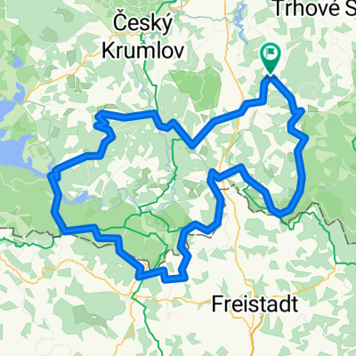
HRADIŠTĚ – BENEŠOV NAD ČERNOU – POHORSKÁ VES - HUŤSKÝ RYBNÍK – ČERNÉ ÚDOLÍ – BENEŠOV – HRADIŠTĚHradiště – road descent – Ličov – climb to Benešov n. Černou – Benešov square – shopping – turn to the right at Kuří ( blue ) – Vídrholec – climb – asphalt through the forest – blueberries - Lužnice – Pohorská Ves - further on the green - turn left off the road – Terčí Dvůr – climb through the field path – around the pasture – forest path – descent to Huťský pond – former Terčí Huť - long descent on asphalt forest road – along Huťský stream - Žofín – still on the green – climb on the road – turn right into the forest – along the contour through the forest – perpendicular descent through the forest ( roots, trees – return to the road – Starý Holand – a piece along the road through the forest – turn left ( green ) to Velký Jindřichov – climb around the pasture – Velký Jindřichov ( lonely cottages ) – descent on asphalt – in the forest green 5 red – left on red – descent across the field into Benešov - return along the road to Hradiště
- -:--
- Duration
- 38.2 km
- Distance
- 696 m
- Ascent
- 696 m
- Descent
- ---
- Avg. speed
- ---
- Max. altitude

Route quality
Waytypes & surfaces along the route
Waytypes
Track
14.1 km
(37 %)
Road
8.4 km
(22 %)
Surfaces
Paved
17.9 km
(47 %)
Unpaved
6.5 km
(17 %)
Asphalt
14.1 km
(37 %)
Paved (undefined)
3.8 km
(10 %)
Continue with Bikemap
Use, edit, or download this cycling route
You would like to ride Novohradské hory 01 or customize it for your own trip? Here is what you can do with this Bikemap route:
Free features
- Save this route as favorite or in collections
- Copy & plan your own version of this route
- Sync your route with Garmin or Wahoo
Premium features
Free trial for 3 days, or one-time payment. More about Bikemap Premium.
- Navigate this route on iOS & Android
- Export a GPX / KML file of this route
- Create your custom printout (try it for free)
- Download this route for offline navigation
Discover more Premium features.
Get Bikemap PremiumFrom our community
Other popular routes starting in Kaplice
 2014_12 Kaplice_Kaplice nádraží pěšky
- Distance
- 9.7 km
- Ascent
- 173 m
- Descent
- 115 m
- Location
- Kaplice, Jihočeský kraj, Czechia
 Kaplice-Lanterna
- Distance
- 629.7 km
- Ascent
- 2,227 m
- Descent
- 2,807 m
- Location
- Kaplice, Jihočeský kraj, Czechia
 kola2013
- Distance
- 137.2 km
- Ascent
- 1,159 m
- Descent
- 1,159 m
- Location
- Kaplice, Jihočeský kraj, Czechia
 2022_05 Sokolčí, Hradiště pěšky
- Distance
- 14.6 km
- Ascent
- 1,097 m
- Descent
- 1,099 m
- Location
- Kaplice, Jihočeský kraj, Czechia
 Kleť
Kleť- Distance
- 70.9 km
- Ascent
- 675 m
- Descent
- 680 m
- Location
- Kaplice, Jihočeský kraj, Czechia
 Nedělní švih
- Distance
- 53.9 km
- Ascent
- 654 m
- Descent
- 654 m
- Location
- Kaplice, Jihočeský kraj, Czechia
 Hradiště-Cetviny-malonty-Hradiště
- Distance
- 41.8 km
- Ascent
- 501 m
- Descent
- 505 m
- Location
- Kaplice, Jihočeský kraj, Czechia
 Kaplice(CZ) nach Waldburg(OÖ)
- Distance
- 47.3 km
- Ascent
- 821 m
- Descent
- 740 m
- Location
- Kaplice, Jihočeský kraj, Czechia
Open it in the app