

Igaratá/Santa Isabel/ ouro fino/ Arujá.
A cycling route starting in Arujá, São Paulo, Brazil.
Overview
About this route
- 7 h 51 min
- Duration
- 106.4 km
- Distance
- 1,652 m
- Ascent
- 1,680 m
- Descent
- 13.6 km/h
- Avg. speed
- 827 m
- Max. altitude

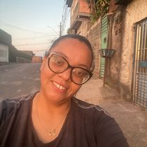
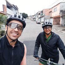
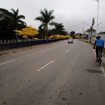
Route photos


Continue with Bikemap
Use, edit, or download this cycling route
You would like to ride Igaratá/Santa Isabel/ ouro fino/ Arujá. or customize it for your own trip? Here is what you can do with this Bikemap route:
Free features
- Save this route as favorite or in collections
- Copy & plan your own version of this route
- Split it into stages to create a multi-day tour
- Sync your route with Garmin or Wahoo
Premium features
Free trial for 3 days, or one-time payment. More about Bikemap Premium.
- Navigate this route on iOS & Android
- Export a GPX / KML file of this route
- Create your custom printout (try it for free)
- Download this route for offline navigation
Discover more Premium features.
Get Bikemap PremiumFrom our community
Other popular routes starting in Arujá
 Pico do urubu.
- Distance
- 65.3 km
- Ascent
- 1,733 m
- Descent
- 1,763 m
- Location
- Arujá, São Paulo, Brazil
 Pano - casa
- Distance
- 5.9 km
- Ascent
- 77 m
- Descent
- 42 m
- Location
- Arujá, São Paulo, Brazil
 Treino com a Sônia!
- Distance
- 25.9 km
- Ascent
- 685 m
- Descent
- 716 m
- Location
- Arujá, São Paulo, Brazil
 Santa Isabel 🐢
- Distance
- 44.2 km
- Ascent
- 438 m
- Descent
- 471 m
- Location
- Arujá, São Paulo, Brazil
 Mairiporã!
- Distance
- 70.3 km
- Ascent
- 1,811 m
- Descent
- 1,842 m
- Location
- Arujá, São Paulo, Brazil
 Igaratá/Santa Isabel/ ouro fino/ Arujá.
- Distance
- 106.4 km
- Ascent
- 1,652 m
- Descent
- 1,680 m
- Location
- Arujá, São Paulo, Brazil
 Pedal AmBev.
- Distance
- 18.9 km
- Ascent
- 326 m
- Descent
- 315 m
- Location
- Arujá, São Paulo, Brazil
 Arujá 🐢
- Distance
- 31.4 km
- Ascent
- 561 m
- Descent
- 583 m
- Location
- Arujá, São Paulo, Brazil
Open it in the app