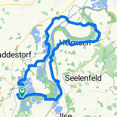
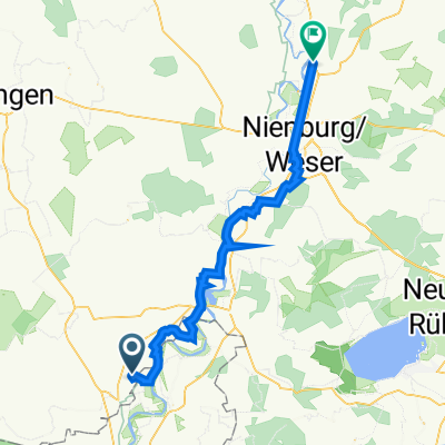
Weserradweg - ADFC - Empfehlung 2011
- 85.1 km
- 26 m
- 49 m
- Raddestorf, Lower Saxony, Germany
A cycling route starting in Raddestorf, Lower Saxony, Germany.
Overview
Weser Cycle Path - ADFC - Recommendation 2011 for the district of Nienburg
created this 14 years ago
Route quality
Quiet road
40.9 km
(48 %)
Track
25.5 km
(30 %)
Paved
65.5 km
(77 %)
Unpaved
1.7 km
(2 %)
Asphalt
56.2 km
(66 %)
Concrete
9.4 km
(11 %)
Continue with Bikemap
You would like to ride Weserradweg - ADFC - Empfehlung 2011 or customize it for your own trip? Here is what you can do with this Bikemap route:
Free trial for 3 days, or one-time payment. More about Bikemap Premium.
Discover more Premium features.
Get Bikemap PremiumFrom our community
Open it in the app