

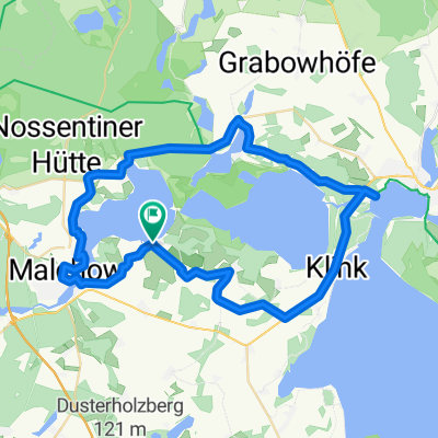
Tag 2
A cycling route starting in Malchow, Mecklenburg-Vorpommern, Germany.
Overview
About this route
- -:--
- Duration
- 55.5 km
- Distance
- 308 m
- Ascent
- 305 m
- Descent
- ---
- Avg. speed
- 104 m
- Max. altitude

Route quality
Waytypes & surfaces along the route
Waytypes
Path
20.5 km
(37 %)
Quiet road
13.9 km
(25 %)
Surfaces
Paved
27.2 km
(49 %)
Unpaved
13.3 km
(24 %)
Asphalt
18.9 km
(34 %)
Ground
6.7 km
(12 %)
Continue with Bikemap
Use, edit, or download this cycling route
You would like to ride Tag 2 or customize it for your own trip? Here is what you can do with this Bikemap route:
Free features
- Save this route as favorite or in collections
- Copy & plan your own version of this route
- Sync your route with Garmin or Wahoo
Premium features
Free trial for 3 days, or one-time payment. More about Bikemap Premium.
- Navigate this route on iOS & Android
- Export a GPX / KML file of this route
- Create your custom printout (try it for free)
- Download this route for offline navigation
Discover more Premium features.
Get Bikemap PremiumFrom our community
Other popular routes starting in Malchow
 Müritz 1 Fleesensee Kolpinsee Eiszeitroute Teile
- Distance
- 49.2 km
- Ascent
- 157 m
- Descent
- 157 m
- Location
- Malchow, Mecklenburg-Vorpommern, Germany
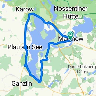
 2008-07-14 Rund um den Plauer See
- Distance
- 43.6 km
- Ascent
- 182 m
- Descent
- 182 m
- Location
- Malchow, Mecklenburg-Vorpommern, Germany
 Plau am See über Malchow
- Distance
- 28.4 km
- Ascent
- 157 m
- Descent
- 157 m
- Location
- Malchow, Mecklenburg-Vorpommern, Germany
 Malchow nach Lenz
- Distance
- 9.5 km
- Ascent
- 129 m
- Descent
- 130 m
- Location
- Malchow, Mecklenburg-Vorpommern, Germany
 Durch die Nossentiner-Schwinzer-Heide
- Distance
- 40 km
- Ascent
- 137 m
- Descent
- 137 m
- Location
- Malchow, Mecklenburg-Vorpommern, Germany
 um den Fleesensee und Kölpinsee
- Distance
- 46.4 km
- Ascent
- 166 m
- Descent
- 166 m
- Location
- Malchow, Mecklenburg-Vorpommern, Germany
 Bootstour Jabel-Plau am See
- Distance
- 40.7 km
- Ascent
- 69 m
- Descent
- 68 m
- Location
- Malchow, Mecklenburg-Vorpommern, Germany
 Route in Malchow
- Distance
- 49.3 km
- Ascent
- 374 m
- Descent
- 371 m
- Location
- Malchow, Mecklenburg-Vorpommern, Germany
Open it in the app