
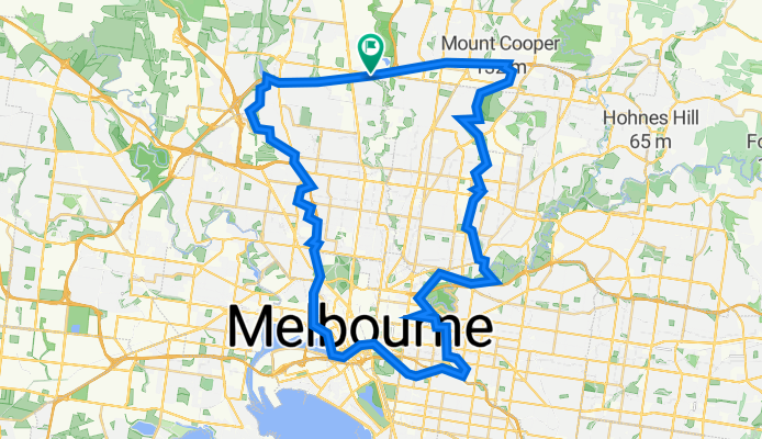
Yarra River - Darebin Creek - Western/Metropolitan Ring Road - Moonee Ponds Creek - Docklands
A cycling route starting in Campbellfield, Victoria, Australia.
Overview
About this route
Distance: 74 km Elevation: 8 mMaximum Elevation: 114 m
- -:--
- Duration
- 73.4 km
- Distance
- 0 m
- Ascent
- 0 m
- Descent
- ---
- Avg. speed
- 0 m
- Max. altitude

Route quality
Waytypes & surfaces along the route
Waytypes
Cycleway
65 km
(89 %)
Quiet road
4.5 km
(6 %)
Surfaces
Paved
71 km
(97 %)
Unpaved
0.7 km
(<1 %)
Concrete
35.4 km
(48 %)
Asphalt
24 km
(33 %)
Continue with Bikemap
Use, edit, or download this cycling route
You would like to ride Yarra River - Darebin Creek - Western/Metropolitan Ring Road - Moonee Ponds Creek - Docklands or customize it for your own trip? Here is what you can do with this Bikemap route:
Free features
- Save this route as favorite or in collections
- Copy & plan your own version of this route
- Sync your route with Garmin or Wahoo
Premium features
Free trial for 3 days, or one-time payment. More about Bikemap Premium.
- Navigate this route on iOS & Android
- Export a GPX / KML file of this route
- Create your custom printout (try it for free)
- Download this route for offline navigation
Discover more Premium features.
Get Bikemap PremiumFrom our community
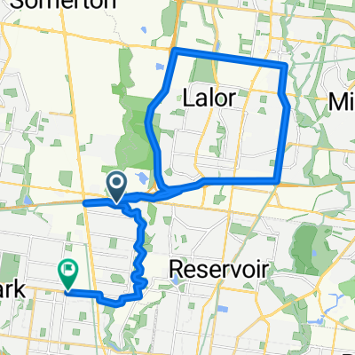
Other popular routes starting in Campbellfield
 Moonee Ponds Creek - Western/Metropolitan Ring Rd - Darebin Creek - Yarra River - Capital City Trail
- Distance
- 60.9 km
- Ascent
- 397 m
- Descent
- 396 m
- Location
- Campbellfield, Victoria, Australia
 Merri to Moonee
- Distance
- 41.7 km
- Ascent
- 141 m
- Descent
- 141 m
- Location
- Campbellfield, Victoria, Australia
 Lengthy bike tour from Fawkner to Hadfield
- Distance
- 30.7 km
- Ascent
- 87 m
- Descent
- 103 m
- Location
- Campbellfield, Victoria, Australia
 Merri Creek Trl, Fawkner to 46 St Kilda Rd, Southbank
- Distance
- 33.2 km
- Ascent
- 174 m
- Descent
- 234 m
- Location
- Campbellfield, Victoria, Australia
 Diamond Ck rtn Warrandyte
- Distance
- 66.4 km
- Ascent
- 827 m
- Descent
- 841 m
- Location
- Campbellfield, Victoria, Australia
 Merri Creek
- Distance
- 20.1 km
- Ascent
- 25 m
- Descent
- 92 m
- Location
- Campbellfield, Victoria, Australia
 Moonee Ponds Cr - Capital City Tr - Merri Cr - Galada Tamboore, Malcolm & Aitkins Crs, Broadmeadows Valley
- Distance
- 72.3 km
- Ascent
- 457 m
- Descent
- 460 m
- Location
- Campbellfield, Victoria, Australia
 Anniversary Trail- Darebin Creek- Western Ring Road - Moonee Ponds Creek Inner Circle Railway - Merri Creek- Yarra River- Gardiners Creek
- Distance
- 83.8 km
- Ascent
- 524 m
- Descent
- 524 m
- Location
- Campbellfield, Victoria, Australia
Open it in the app