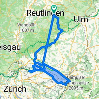
Auf der Alb
- 31.3 km
- 500 m
- 487 m
- Bad Urach, Baden-Wurttemberg, Germany
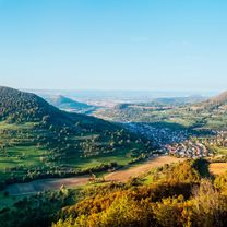
Schwäbische Alb Schwarzwald
A cycling route starting in Bad Urach, Baden-Wurttemberg, Germany.
Overview
Author: Schwäbische Alb Tourismusverband e.V. - Author: Schwäbische Alb Tourismusverband e.V.
created this 2 years ago
Part of
7 stages
Route quality
Track
29.9 km
(61 %)
Quiet road
9.3 km
(19 %)
Paved
26.5 km
(54 %)
Unpaved
21.1 km
(43 %)
Asphalt
25.5 km
(52 %)
Gravel
14.7 km
(30 %)
Continue with Bikemap
You would like to ride SAS-0104a Bad Urach bis Tübingen or customize it for your own trip? Here is what you can do with this Bikemap route:
Free trial for 3 days, or one-time payment. More about Bikemap Premium.
Discover more Premium features.
Get Bikemap PremiumFrom our community
Open it in the app