

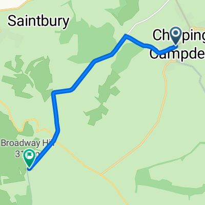
OBGW ride Chipping Campden loop
A cycling route starting in Chipping Campden, England, United Kingdom.
Overview
About this route
- 7 h 14 min
- Duration
- 38.2 km
- Distance
- 0 m
- Ascent
- 0 m
- Descent
- 5.3 km/h
- Avg. speed
- 0 m
- Max. altitude
Continue with Bikemap
Use, edit, or download this cycling route
You would like to ride OBGW ride Chipping Campden loop or customize it for your own trip? Here is what you can do with this Bikemap route:
Free features
- Save this route as favorite or in collections
- Copy & plan your own version of this route
- Sync your route with Garmin or Wahoo
Premium features
Free trial for 3 days, or one-time payment. More about Bikemap Premium.
- Navigate this route on iOS & Android
- Export a GPX / KML file of this route
- Create your custom printout (try it for free)
- Download this route for offline navigation
Discover more Premium features.
Get Bikemap PremiumFrom our community
Other popular routes starting in Chipping Campden
 Cotswolds Day 4 - Chipping Campden to Stratford circular
- Distance
- 51.4 km
- Ascent
- 433 m
- Descent
- 432 m
- Location
- Chipping Campden, England, United Kingdom
 Chipping Campden back to Moreton in Marsh
- Distance
- 10.2 km
- Ascent
- 120 m
- Descent
- 136 m
- Location
- Chipping Campden, England, United Kingdom
 chipping campden to Broadway tower
- Distance
- 5.8 km
- Ascent
- 166 m
- Descent
- 4 m
- Location
- Chipping Campden, England, United Kingdom
 Chipping Campden - Sedgeberrow Circular (Alt 2)
- Distance
- 34.1 km
- Ascent
- 366 m
- Descent
- 367 m
- Location
- Chipping Campden, England, United Kingdom
 Cotswold Day 5 - Chipping Campden to Ashton under Hill Circular
- Distance
- 44 km
- Ascent
- 480 m
- Descent
- 479 m
- Location
- Chipping Campden, England, United Kingdom
 Wand Cotswlds 17.7.7
- Distance
- 13.3 km
- Ascent
- 191 m
- Descent
- 191 m
- Location
- Chipping Campden, England, United Kingdom
 OBGW ride Chipping Campden loop
- Distance
- 38.2 km
- Ascent
- 0 m
- Descent
- 0 m
- Location
- Chipping Campden, England, United Kingdom
 Cotswold 2, Slaughters-Ebrington
- Distance
- 22.3 km
- Ascent
- 258 m
- Descent
- 261 m
- Location
- Chipping Campden, England, United Kingdom
Open it in the app