
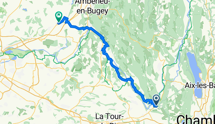
Montée de la Vie 1024, Champagneux nach Avenue de Verdun 35, Meximieux
A cycling route starting in Saint-Genix-sur-Guiers, Auvergne-Rhône-Alpes, France.
Overview
About this route
- 4 h 25 min
- Duration
- 70.9 km
- Distance
- 358 m
- Ascent
- 417 m
- Descent
- 16 km/h
- Avg. speed
- 306 m
- Max. altitude

Route quality
Waytypes & surfaces along the route
Waytypes
Quiet road
23.9 km
(34 %)
Cycleway
14.7 km
(21 %)
Surfaces
Paved
34.4 km
(48 %)
Unpaved
1.3 km
(2 %)
Asphalt
34.4 km
(48 %)
Loose gravel
1.3 km
(2 %)
Undefined
35.2 km
(50 %)
Continue with Bikemap
Use, edit, or download this cycling route
You would like to ride Montée de la Vie 1024, Champagneux nach Avenue de Verdun 35, Meximieux or customize it for your own trip? Here is what you can do with this Bikemap route:
Free features
- Save this route as favorite or in collections
- Copy & plan your own version of this route
- Sync your route with Garmin or Wahoo
Premium features
Free trial for 3 days, or one-time payment. More about Bikemap Premium.
- Navigate this route on iOS & Android
- Export a GPX / KML file of this route
- Create your custom printout (try it for free)
- Download this route for offline navigation
Discover more Premium features.
Get Bikemap PremiumFrom our community
Other popular routes starting in Saint-Genix-sur-Guiers
 étape 5 jours 2
- Distance
- 14.4 km
- Ascent
- 59 m
- Descent
- 75 m
- Location
- Saint-Genix-sur-Guiers, Auvergne-Rhône-Alpes, France
 France 2013 - day 3
- Distance
- 93.2 km
- Ascent
- 1,430 m
- Descent
- 1,449 m
- Location
- Saint-Genix-sur-Guiers, Auvergne-Rhône-Alpes, France
 Basel - Nice, Tag 9 (St.Genix - Beauvoir en Royans)
- Distance
- 82.7 km
- Ascent
- 697 m
- Descent
- 678 m
- Location
- Saint-Genix-sur-Guiers, Auvergne-Rhône-Alpes, France
 2021_2.Etappe: Avenières/Saint-Genix – Lyon
- Distance
- 120.1 km
- Ascent
- 161 m
- Descent
- 248 m
- Location
- Saint-Genix-sur-Guiers, Auvergne-Rhône-Alpes, France
 VR09 Champagneux-Lagnieu.kml - VR09 Champagneux-Lagnieu.kml_VR09 Champagneux-Lagnieu
- Distance
- 69.3 km
- Ascent
- 207 m
- Descent
- 219 m
- Location
- Saint-Genix-sur-Guiers, Auvergne-Rhône-Alpes, France
 Fr - Saint-genix-sur-guiers a CH BASEL
- Distance
- 429.7 km
- Ascent
- 1,244 m
- Descent
- 1,202 m
- Location
- Saint-Genix-sur-Guiers, Auvergne-Rhône-Alpes, France
 Saint-Genix-les-Villages nach Aoste
- Distance
- 146.3 km
- Ascent
- 980 m
- Descent
- 987 m
- Location
- Saint-Genix-sur-Guiers, Auvergne-Rhône-Alpes, France
 Murs-et-Gélignieux nach Brégnier-Cordon
- Distance
- 142.3 km
- Ascent
- 924 m
- Descent
- 919 m
- Location
- Saint-Genix-sur-Guiers, Auvergne-Rhône-Alpes, France
Open it in the app