58km pelo Morro do São Domingos
A cycling route starting in Caculé, Estado de Bahia, Brazil.
Overview
About this route
Rota bem pesada passando pelo apostema, Tigui, Marruaz, São Domingos, Lagoa Feia, Taboril, Truvisco, comocoxico e chegando a Caculé.
- -:--
- Duration
- 57.4 km
- Distance
- 553 m
- Ascent
- 553 m
- Descent
- ---
- Avg. speed
- ---
- Avg. speed
Continue with Bikemap
Use, edit, or download this cycling route
You would like to ride 58km pelo Morro do São Domingos or customize it for your own trip? Here is what you can do with this Bikemap route:
Free features
- Save this route as favorite or in collections
- Copy & plan your own version of this route
- Sync your route with Garmin or Wahoo
Premium features
Free trial for 3 days, or one-time payment. More about Bikemap Premium.
- Navigate this route on iOS & Android
- Export a GPX / KML file of this route
- Create your custom printout (try it for free)
- Download this route for offline navigation
Discover more Premium features.
Get Bikemap PremiumFrom our community
Other popular routes starting in Caculé
- 60km - Sul e Norte de Caculé!
- Distance
- 60.4 km
- Ascent
- 496 m
- Descent
- 496 m
- Location
- Caculé, Estado de Bahia, Brazil
- Treino Circuito Leve Caculé
- Distance
- 3.5 km
- Ascent
- 39 m
- Descent
- 40 m
- Location
- Caculé, Estado de Bahia, Brazil
- 35km roças
- Distance
- 34.3 km
- Ascent
- 368 m
- Descent
- 368 m
- Location
- Caculé, Estado de Bahia, Brazil
- 40 km - Caculé, Apostema, Tingui, Agua Boa, Tamboril, Truvisco, Comocoxico, Caculé.
- Distance
- 40.3 km
- Ascent
- 440 m
- Descent
- 440 m
- Location
- Caculé, Estado de Bahia, Brazil
- 50km - Clé/Rio do Antonio - Volta Caminho 1
- Distance
- 50 km
- Ascent
- 391 m
- Descent
- 391 m
- Location
- Caculé, Estado de Bahia, Brazil
- 58km pelo Morro do São Domingos
- Distance
- 57.4 km
- Ascent
- 553 m
- Descent
- 553 m
- Location
- Caculé, Estado de Bahia, Brazil
- 55km Postema, Sao Domingos, Tamboril, Comoca
- Distance
- 54.3 km
- Ascent
- 513 m
- Descent
- 513 m
- Location
- Caculé, Estado de Bahia, Brazil
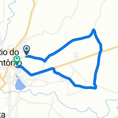
- 32km - Escola Agricola Invertida
- Distance
- 32.4 km
- Ascent
- 363 m
- Descent
- 363 m
- Location
- Caculé, Estado de Bahia, Brazil
Open it in the app