
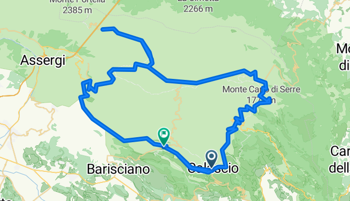
Campo Imperatore - die Königstour
A cycling route starting in Calascio, Abruzzo, Italy.
Overview
About this route
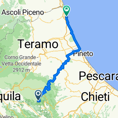
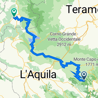
Der Startschuss ertönt im wundervollen Santo Stefano. Unbedingt Zeit für eine kurze Besichtigung einplanen. Einrollen bis Calascio, oberhalb thront eine der schönsten Burgen Italiens Roccacalascio (Drehort "Der Name der Rose"). Es geht gemach hoch nach Castel del Monte, danach etwas steiler hoch zum Campo Imperatore, der größten Hochebene Europas. Flankiert von zahllosen markanten Fastdreitausendern auf einer absoluten Traumstraße immer leicht ansteigend bis zum Ende der Sackgasse am Fuß des Corno Grande, des höchsten Gipfels der Abruzzen. Zunächst auf gleichem Weg über herrliche, weit geschwungene Kehren bergab bis zur zweiten Kreuzung. Dort rechts über den Monte Cecco d'Antonio runter nach Santo Stefano.
- -:--
- Duration
- 91.4 km
- Distance
- 1,260 m
- Ascent
- 1,283 m
- Descent
- ---
- Avg. speed
- ---
- Max. altitude
Route quality
Waytypes & surfaces along the route
Waytypes
Busy road
70.3 km
(77 %)
Quiet road
10.1 km
(11 %)
Surfaces
Paved
53.2 km
(58 %)
Unpaved
9.3 km
(10 %)
Asphalt
51.4 km
(56 %)
Gravel
6.9 km
(8 %)
Continue with Bikemap
Use, edit, or download this cycling route
You would like to ride Campo Imperatore - die Königstour or customize it for your own trip? Here is what you can do with this Bikemap route:
Free features
- Save this route as favorite or in collections
- Copy & plan your own version of this route
- Split it into stages to create a multi-day tour
- Sync your route with Garmin or Wahoo
Premium features
Free trial for 3 days, or one-time payment. More about Bikemap Premium.
- Navigate this route on iOS & Android
- Export a GPX / KML file of this route
- Create your custom printout (try it for free)
- Download this route for offline navigation
Discover more Premium features.
Get Bikemap PremiumFrom our community
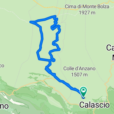
Other popular routes starting in Calascio
 circuito ruderi abbazia benedettina
- Distance
- 25.2 km
- Ascent
- 567 m
- Descent
- 566 m
- Location
- Calascio, Abruzzo, Italy
 campo imperatore
- Distance
- 26.4 km
- Ascent
- 903 m
- Descent
- 255 m
- Location
- Calascio, Abruzzo, Italy
 variante abbazia
- Distance
- 26.4 km
- Ascent
- 720 m
- Descent
- 722 m
- Location
- Calascio, Abruzzo, Italy
 Calascio - Alba
- Distance
- 113.2 km
- Ascent
- 1,072 m
- Descent
- 2,284 m
- Location
- Calascio, Abruzzo, Italy
 Zeppelin_TREKKING_ParchiD'Abruzzo2_2015
- Distance
- 207 km
- Ascent
- 4,227 m
- Descent
- 4,606 m
- Location
- Calascio, Abruzzo, Italy
 R9 Calascio - Amatrice
- Distance
- 103.5 km
- Ascent
- 2,108 m
- Descent
- 2,309 m
- Location
- Calascio, Abruzzo, Italy
 Calascio-Santo Stefano di Sessanio-Grotte di Stiffe
- Distance
- 53.2 km
- Ascent
- 1,029 m
- Descent
- 1,029 m
- Location
- Calascio, Abruzzo, Italy
 Day 7 - Campsite to L'aguila
- Distance
- 37.4 km
- Ascent
- 507 m
- Descent
- 1,013 m
- Location
- Calascio, Abruzzo, Italy
Open it in the app