

Durch das Tal der klappernden Wassermühlen
A cycling route starting in Haßfurt, Bavaria, Germany.
Overview
About this route
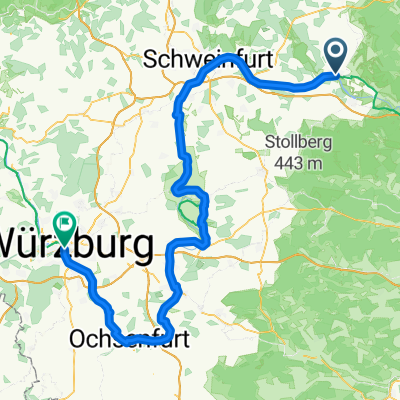
The small stream Steinach, which comes from the Schweinfurt uplands and flows into the Main at Schonungen, was for a long time THE lifeline in this picturesque region between Haßfurt and Schweinfurt. Several mills, still preserved today, testify to the close connection between man and river and how centuries ago the energy of water was harnessed. The expansiveness of the Main valley and the narrow, almost canyon-like natural idyll of the Wässernachtal, through which the rest of the route leads, show further facets of the man-water relationship. A tour for all who enjoy technology and nature and are not entirely averse to the element of water. Tour Starting from the center of Haßfurt, the tour leads directly to the water and along the Main cycling path to Schonungen. There the valley of the clattering watermills begins: until Marktsteinach, the Klüpfelsmühle, Betzenmühle, Schulzenmühle, Ölmühle and Rothmühle lie more or less directly along the way. From the ruin of Marktsteinach, located in the center of the village, the path then leads away from the Steinach and with a good climb into the Schweinfurt uplands all the way up to the picturesque Sailershausen. Through a steep but short passage (see note below), it then descends again into the idyllic Wässernachtal, whose course the tour follows up to its confluence with the Main. From Wülflingen, it returns along the Main cycling path back to Haßfurt. Attention: The descent from Sailershausen into the Wässernachtal runs over a gravel forest path that is quite short but fairly steep. We strongly recommend that inexperienced cyclists and bikes with thin or low-profile tires approach this section with caution or to push it! Tips and further information Start For the tour, we recommend starting at the market square of the city of Haßfurt. As this is a circular route, it can be joined anywhere along the way. Stops A stop along the way is possible in Untertheres, Ottendorf, Schonungen, Marktsteinach, Rednershof, and Wülflingen. Back in Haßfurt, you will again have the problem of choosing among several gastronomic establishments. Please check in advance for the current opening hours.
- 2 h 46 min
- Duration
- 39.9 km
- Distance
- 0 m
- Ascent
- 0 m
- Descent
- 14.4 km/h
- Avg. speed
- 0 m
- Max. altitude

Route quality
Waytypes & surfaces along the route
Waytypes
Path
17.2 km
(43 %)
Quiet road
9.6 km
(24 %)
Surfaces
Paved
31.9 km
(80 %)
Unpaved
6.8 km
(17 %)
Asphalt
29.5 km
(74 %)
Gravel
5.2 km
(13 %)
Continue with Bikemap
Use, edit, or download this cycling route
You would like to ride Durch das Tal der klappernden Wassermühlen or customize it for your own trip? Here is what you can do with this Bikemap route:
Free features
- Save this route as favorite or in collections
- Copy & plan your own version of this route
- Sync your route with Garmin or Wahoo
Premium features
Free trial for 3 days, or one-time payment. More about Bikemap Premium.
- Navigate this route on iOS & Android
- Export a GPX / KML file of this route
- Create your custom printout (try it for free)
- Download this route for offline navigation
Discover more Premium features.
Get Bikemap PremiumFrom our community
Other popular routes starting in Haßfurt
 Bergrheinfeld - Wurzburg
- Distance
- 111.1 km
- Ascent
- 386 m
- Descent
- 443 m
- Location
- Haßfurt, Bavaria, Germany
 Haßberge - Bamberg - Hassfurt
- Distance
- 79.8 km
- Ascent
- 749 m
- Descent
- 730 m
- Location
- Haßfurt, Bavaria, Germany
 Durch das Tal der klappernden Wassermühlen
- Distance
- 39.9 km
- Ascent
- 0 m
- Descent
- 0 m
- Location
- Haßfurt, Bavaria, Germany
 2015_Berlin - Büttikon_009
- Distance
- 106.6 km
- Ascent
- 192 m
- Descent
- 111 m
- Location
- Haßfurt, Bavaria, Germany
 MTB Masserberg
- Distance
- 80.9 km
- Ascent
- 1,326 m
- Descent
- 757 m
- Location
- Haßfurt, Bavaria, Germany
 Lindenhainstraße, Haßfurt nach Bamberger Straße, Lichtenfels
- Distance
- 89.7 km
- Ascent
- 2,568 m
- Descent
- 2,514 m
- Location
- Haßfurt, Bavaria, Germany
 Coronarunde 2
- Distance
- 13.9 km
- Ascent
- 266 m
- Descent
- 264 m
- Location
- Haßfurt, Bavaria, Germany
 Königsberg in Bayern (40,3 km)
- Distance
- 42.2 km
- Ascent
- 617 m
- Descent
- 618 m
- Location
- Haßfurt, Bavaria, Germany
Open it in the app