

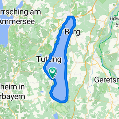
Starnberger See - Andechs - Starnberg
A cycling route starting in Bernried, Bavaria, Germany.
Overview
About this route
Nette Tour über Stock und Stein. Leider kann die Route nicht nachgefahren werden, weil die Strecke nicht genau eingetragen werden konnte.
- -:--
- Duration
- 65.6 km
- Distance
- 418 m
- Ascent
- 418 m
- Descent
- ---
- Avg. speed
- ---
- Max. altitude

Continue with Bikemap
Use, edit, or download this cycling route
You would like to ride Starnberger See - Andechs - Starnberg or customize it for your own trip? Here is what you can do with this Bikemap route:
Free features
- Save this route as favorite or in collections
- Copy & plan your own version of this route
- Sync your route with Garmin or Wahoo
Premium features
Free trial for 3 days, or one-time payment. More about Bikemap Premium.
- Navigate this route on iOS & Android
- Export a GPX / KML file of this route
- Create your custom printout (try it for free)
- Download this route for offline navigation
Discover more Premium features.
Get Bikemap PremiumFrom our community
Other popular routes starting in Bernried
 Runde Starnbergersee ab Hotel Seeblick Dorfstraße
- Distance
- 51.3 km
- Ascent
- 449 m
- Descent
- 448 m
- Location
- Bernried, Bavaria, Germany
 Um den Ammersee ab Gasthaus Steidl
- Distance
- 71.9 km
- Ascent
- 496 m
- Descent
- 497 m
- Location
- Bernried, Bavaria, Germany
 Bahnhofstraße 25, Bernried am Starnberger See nach Bahnhofstraße 25, Bernried am Starnberger See
- Distance
- 56.9 km
- Ascent
- 531 m
- Descent
- 532 m
- Location
- Bernried, Bavaria, Germany
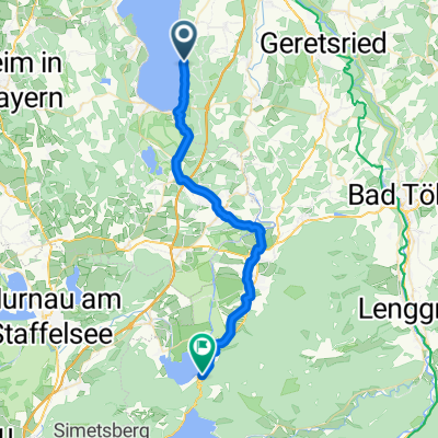
 Bernried-Staffelsee-Riegsee H80
- Distance
- 65.5 km
- Ascent
- 667 m
- Descent
- 667 m
- Location
- Bernried, Bavaria, Germany
 day 2
day 2- Distance
- 33.9 km
- Ascent
- 268 m
- Descent
- 228 m
- Location
- Bernried, Bavaria, Germany
 Runde Starnbergersee ab Bernried H80-1
- Distance
- 59.7 km
- Ascent
- 515 m
- Descent
- 515 m
- Location
- Bernried, Bavaria, Germany
 Runde Bernried, Staffelsee, Osterseen H80
- Distance
- 76 km
- Ascent
- 837 m
- Descent
- 837 m
- Location
- Bernried, Bavaria, Germany
 Etape 6
- Distance
- 57.7 km
- Ascent
- 566 m
- Descent
- 696 m
- Location
- Bernried, Bavaria, Germany
Open it in the app