

prueba
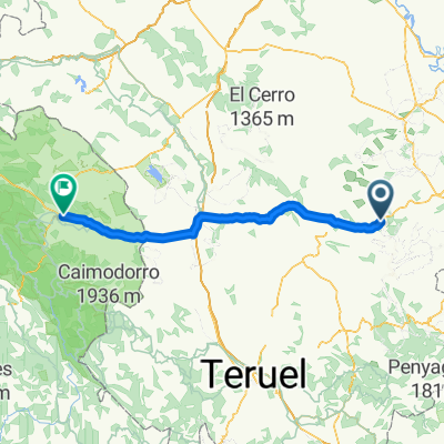
A cycling route starting in Gargallo, Aragon, Spain.
Overview
About this route
- -:--
- Duration
- 19 km
- Distance
- 480 m
- Ascent
- 428 m
- Descent
- ---
- Avg. speed
- 1,070 m
- Max. altitude
Route quality
Waytypes & surfaces along the route
Waytypes
Road
15.6 km
(82 %)
Cycleway
3 km
(16 %)
Undefined
0.4 km
(2 %)
Continue with Bikemap
Use, edit, or download this cycling route
You would like to ride prueba or customize it for your own trip? Here is what you can do with this Bikemap route:
Free features
- Save this route as favorite or in collections
- Copy & plan your own version of this route
- Sync your route with Garmin or Wahoo
Premium features
Free trial for 3 days, or one-time payment. More about Bikemap Premium.
- Navigate this route on iOS & Android
- Export a GPX / KML file of this route
- Create your custom printout (try it for free)
- Download this route for offline navigation
Discover more Premium features.
Get Bikemap PremiumFrom our community
Other popular routes starting in Gargallo
 Los Degollaos
- Distance
- 138.1 km
- Ascent
- 2,014 m
- Descent
- 2,016 m
- Location
- Gargallo, Aragon, Spain
 Gran Maestre
- Distance
- 93.6 km
- Ascent
- 1,698 m
- Descent
- 1,696 m
- Location
- Gargallo, Aragon, Spain
 prueba
- Distance
- 19 km
- Ascent
- 480 m
- Descent
- 428 m
- Location
- Gargallo, Aragon, Spain
 N-211, Gargallo a Carretera de Teruel, Molina de Aragón
- Distance
- 122.4 km
- Ascent
- 1,839 m
- Descent
- 1,720 m
- Location
- Gargallo, Aragon, Spain
 Venta la Pintada - Cañada de Benatanduz - Venta la Pintada (Teruel)
- Distance
- 97.4 km
- Ascent
- 1,566 m
- Descent
- 1,566 m
- Location
- Gargallo, Aragon, Spain
 La Pintada-Tronchón-Cantavieja-Villarluengo-pitarque-La Pintada.
- Distance
- 165.4 km
- Ascent
- 4,976 m
- Descent
- 4,781 m
- Location
- Gargallo, Aragon, Spain
 De Calle Vta Pintada 3 a A-1702, Gargallo
- Distance
- 457.4 km
- Ascent
- 11,329 m
- Descent
- 11,327 m
- Location
- Gargallo, Aragon, Spain
 La Pintá-Villarluengo-Tronchón-Olocau del rey-Tronchón-Villarluengo-Pitarque-La Pintá.
- Distance
- 142.7 km
- Ascent
- 3,863 m
- Descent
- 3,794 m
- Location
- Gargallo, Aragon, Spain
Open it in the app