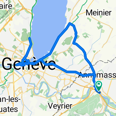
Route des Grandes Alpes 2019 Alt. 2.1 - Tag 1
- 93.5 km
- 1,856 m
- 1,550 m
- Étrembières, Auvergne-Rhône-Alpes, France
A cycling route starting in Étrembières, Auvergne-Rhône-Alpes, France.
Overview
created this 16 years ago
Route quality
Road
24.1 km
(48 %)
Quiet road
12.5 km
(25 %)
Paved
16.1 km
(32 %)
Asphalt
15.5 km
(31 %)
Paved (undefined)
0.5 km
(1 %)
Undefined
34.1 km
(68 %)
Continue with Bikemap
You would like to ride Col d'Evires and Col le Parc or customize it for your own trip? Here is what you can do with this Bikemap route:
Free trial for 3 days, or one-time payment. More about Bikemap Premium.
Discover more Premium features.
Get Bikemap PremiumFrom our community
Open it in the app