

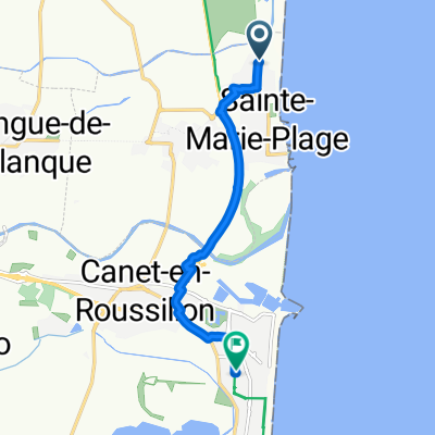
De Les Illes 1443, Sainte-Marie-la-Mer a Chemin du maritime, Narbonne
A cycling route starting in Sainte-Marie-Plage, Occitanie, France.
Overview
About this route
- 4 h 26 min
- Duration
- 61.3 km
- Distance
- 102 m
- Ascent
- 98 m
- Descent
- 13.8 km/h
- Avg. speed
- 50 m
- Max. altitude

Route quality
Waytypes & surfaces along the route
Waytypes
Quiet road
19.6 km
(32 %)
Track
14.1 km
(23 %)
Surfaces
Paved
44.2 km
(72 %)
Unpaved
12.3 km
(20 %)
Asphalt
43.5 km
(71 %)
Gravel
11 km
(18 %)
Continue with Bikemap
Use, edit, or download this cycling route
You would like to ride De Les Illes 1443, Sainte-Marie-la-Mer a Chemin du maritime, Narbonne or customize it for your own trip? Here is what you can do with this Bikemap route:
Free features
- Save this route as favorite or in collections
- Copy & plan your own version of this route
- Sync your route with Garmin or Wahoo
Premium features
Free trial for 3 days, or one-time payment. More about Bikemap Premium.
- Navigate this route on iOS & Android
- Export a GPX / KML file of this route
- Create your custom printout (try it for free)
- Download this route for offline navigation
Discover more Premium features.
Get Bikemap PremiumFrom our community
Other popular routes starting in Sainte-Marie-Plage
 Canet 1
- Distance
- 68.2 km
- Ascent
- 303 m
- Descent
- 302 m
- Location
- Sainte-Marie-Plage, Occitanie, France
 Avenue des Dunes, Sainte-Marie-la-Mer à Rue des Dahlias, Canet-en-Roussillon
- Distance
- 7.6 km
- Ascent
- 8 m
- Descent
- 6 m
- Location
- Sainte-Marie-Plage, Occitanie, France
 Brasilia camping - st. cyprien
- Distance
- 10.7 km
- Ascent
- 6 m
- Descent
- 10 m
- Location
- Sainte-Marie-Plage, Occitanie, France
 stuur Marie rivier la agly rivesaltes pia bompas camping staat marie
- Distance
- 42.7 km
- Ascent
- 45 m
- Descent
- 43 m
- Location
- Sainte-Marie-Plage, Occitanie, France
 AAA Pyrenäen 1
- Distance
- 116.4 km
- Ascent
- 1,995 m
- Descent
- 998 m
- Location
- Sainte-Marie-Plage, Occitanie, France
 Rondje Sainte marie
- Distance
- 18.6 km
- Ascent
- 4 m
- Descent
- 5 m
- Location
- Sainte-Marie-Plage, Occitanie, France
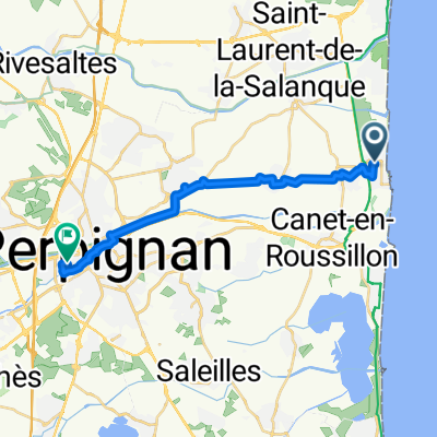 Sainte Marie-Plage2Perpignan Gare
- Distance
- 17.7 km
- Ascent
- 35 m
- Descent
- 0 m
- Location
- Sainte-Marie-Plage, Occitanie, France
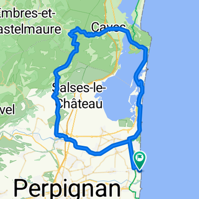 tour du lac
- Distance
- 82.1 km
- Ascent
- 427 m
- Descent
- 429 m
- Location
- Sainte-Marie-Plage, Occitanie, France
Open it in the app