

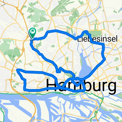
Eimsbüttel-Ulzburg-Tornesch-Eimsbüttel
A cycling route starting in Stellingen, City state of Hamburg, Germany.
Overview
About this route
Nice trip
Mainly asphalt
- -:--
- Duration
- 76 km
- Distance
- 114 m
- Ascent
- 116 m
- Descent
- ---
- Avg. speed
- 40 m
- Max. altitude

Route quality
Waytypes & surfaces along the route
Waytypes
Quiet road
35.7 km
(47 %)
Path
14.4 km
(19 %)
Surfaces
Paved
56.3 km
(74 %)
Unpaved
5.3 km
(7 %)
Asphalt
54 km
(71 %)
Gravel
4.6 km
(6 %)
Continue with Bikemap
Use, edit, or download this cycling route
You would like to ride Eimsbüttel-Ulzburg-Tornesch-Eimsbüttel or customize it for your own trip? Here is what you can do with this Bikemap route:
Free features
- Save this route as favorite or in collections
- Copy & plan your own version of this route
- Sync your route with Garmin or Wahoo
Premium features
Free trial for 3 days, or one-time payment. More about Bikemap Premium.
- Navigate this route on iOS & Android
- Export a GPX / KML file of this route
- Create your custom printout (try it for free)
- Download this route for offline navigation
Discover more Premium features.
Get Bikemap PremiumFrom our community
Other popular routes starting in Stellingen
 2015-08-09 - Elbufer Othmarschen bis Wedel, über Holm und Schenefeld zurück
- Distance
- 55.7 km
- Ascent
- 133 m
- Descent
- 135 m
- Location
- Stellingen, City state of Hamburg, Germany
 trainingsrunde blankenese
- Distance
- 31.7 km
- Ascent
- 211 m
- Descent
- 212 m
- Location
- Stellingen, City state of Hamburg, Germany
 Nord-Ost Rundtour
- Distance
- 49.2 km
- Ascent
- 79 m
- Descent
- 81 m
- Location
- Stellingen, City state of Hamburg, Germany
 Eimsbüttel-Ulzburg-Tornesch-Eimsbüttel
- Distance
- 76 km
- Ascent
- 114 m
- Descent
- 116 m
- Location
- Stellingen, City state of Hamburg, Germany
 Melanchthonstraße nach Melanchthonstraße
- Distance
- 39.5 km
- Ascent
- 910 m
- Descent
- 972 m
- Location
- Stellingen, City state of Hamburg, Germany
 BlankeneseSchenefeld
- Distance
- 33 km
- Ascent
- 71 m
- Descent
- 72 m
- Location
- Stellingen, City state of Hamburg, Germany
 bergtour Stellingen-Blankenese-Stellingen
- Distance
- 31.3 km
- Ascent
- 272 m
- Descent
- 267 m
- Location
- Stellingen, City state of Hamburg, Germany
 S-Stellingen - Haseldorfer Marsch - Kösterberg - S-Altona
- Distance
- 78.5 km
- Ascent
- 174 m
- Descent
- 167 m
- Location
- Stellingen, City state of Hamburg, Germany
Open it in the app