

Cahors - Ride to St-Pierre-Lafeuille and Return
A cycling route starting in Cahors, Occitanie, France.
Overview
About this route
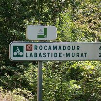
With expected rain storms, we just did a short ride to see what D820 would be like heading north since we'll be heading in that direction with our panniers in a few days. Turned out that there was road shoulder for the entire ride on D820. It wasn't perfectly smooth, but it was good for keeping us off the highway during this climb, which is shown on some signs to be 6%. Nice scenery.
- 1 h 13 min
- Duration
- 15.9 km
- Distance
- 287 m
- Ascent
- 290 m
- Descent
- 13 km/h
- Avg. speed
- 353 m
- Max. altitude

Route quality
Waytypes & surfaces along the route
Waytypes
Busy road
13.7 km
(86 %)
Quiet road
1.9 km
(12 %)
Surfaces
Paved
1.3 km
(8 %)
Unpaved
0.4 km
(2 %)
Asphalt
1.3 km
(8 %)
Gravel
0.4 km
(2 %)
Undefined
14.2 km
(89 %)
Continue with Bikemap
Use, edit, or download this cycling route
You would like to ride Cahors - Ride to St-Pierre-Lafeuille and Return or customize it for your own trip? Here is what you can do with this Bikemap route:
Free features
- Save this route as favorite or in collections
- Copy & plan your own version of this route
- Sync your route with Garmin or Wahoo
Premium features
Free trial for 3 days, or one-time payment. More about Bikemap Premium.
- Navigate this route on iOS & Android
- Export a GPX / KML file of this route
- Create your custom printout (try it for free)
- Download this route for offline navigation
Discover more Premium features.
Get Bikemap PremiumFrom our community
Other popular routes starting in Cahors
 Day 20
- Distance
- 91.1 km
- Ascent
- 337 m
- Descent
- 393 m
- Location
- Cahors, Occitanie, France
 Deutschland - Portugal (Berlin - Faro) FR 26 Cahors - Montauban
- Distance
- 68.8 km
- Ascent
- 901 m
- Descent
- 941 m
- Location
- Cahors, Occitanie, France
 Cahors to Rocamadour - V87 Route
- Distance
- 66.4 km
- Ascent
- 995 m
- Descent
- 1,016 m
- Location
- Cahors, Occitanie, France
 Cahors - St. Gaudens
- Distance
- 200.5 km
- Ascent
- 869 m
- Descent
- 596 m
- Location
- Cahors, Occitanie, France
 Cahors to La Forge (Souillac)
- Distance
- 71.6 km
- Ascent
- 835 m
- Descent
- 840 m
- Location
- Cahors, Occitanie, France
 Cahors-Fumel 57 km
- Distance
- 57 km
- Ascent
- 384 m
- Descent
- 430 m
- Location
- Cahors, Occitanie, France
 Gramat anders
- Distance
- 92.2 km
- Ascent
- 2,089 m
- Descent
- 2,145 m
- Location
- Cahors, Occitanie, France
 Cahors - Circle through Goudon and Le Vigan
- Distance
- 88.2 km
- Ascent
- 1,051 m
- Descent
- 1,051 m
- Location
- Cahors, Occitanie, France
Open it in the app