

Etape 1 Mérigny / Moussac
A cycling route starting in Saint-Savin, Nouvelle-Aquitaine, France.
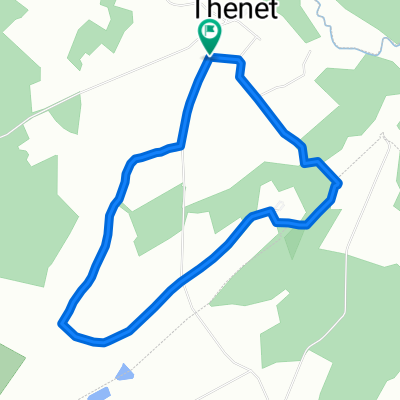
Overview
About this route
Camping de Moussac
05 49 48 75 58
- -:--
- Duration
- 57.4 km
- Distance
- 408 m
- Ascent
- 396 m
- Descent
- ---
- Avg. speed
- 152 m
- Max. altitude

Route quality
Waytypes & surfaces along the route
Waytypes
Quiet road
25.2 km
(44 %)
Road
22.4 km
(39 %)
Surfaces
Paved
2.3 km
(4 %)
Unpaved
5.7 km
(10 %)
Gravel
5.7 km
(10 %)
Asphalt
2.3 km
(4 %)
Undefined
49.3 km
(86 %)
Continue with Bikemap
Use, edit, or download this cycling route
You would like to ride Etape 1 Mérigny / Moussac or customize it for your own trip? Here is what you can do with this Bikemap route:
Free features
- Save this route as favorite or in collections
- Copy & plan your own version of this route
- Sync your route with Garmin or Wahoo
Premium features
Free trial for 3 days, or one-time payment. More about Bikemap Premium.
- Navigate this route on iOS & Android
- Export a GPX / KML file of this route
- Create your custom printout (try it for free)
- Download this route for offline navigation
Discover more Premium features.
Get Bikemap PremiumFrom our community
Other popular routes starting in Saint-Savin
 Merigny-Loches
- Distance
- 65.6 km
- Ascent
- 474 m
- Descent
- 485 m
- Location
- Saint-Savin, Nouvelle-Aquitaine, France
 St Savin (parcours non connu)
- Distance
- 0.7 km
- Ascent
- 0 m
- Descent
- 4 m
- Location
- Saint-Savin, Nouvelle-Aquitaine, France
 Les Chemins de Villesalem / Boucle 8
- Distance
- 4.7 km
- Ascent
- 30 m
- Descent
- 28 m
- Location
- Saint-Savin, Nouvelle-Aquitaine, France
 Etape 1 Mérigny / Moussac
- Distance
- 57.4 km
- Ascent
- 408 m
- Descent
- 396 m
- Location
- Saint-Savin, Nouvelle-Aquitaine, France
 La Meriaudière, Antigny to Boulevard Pont Achard 2, Poitiers
- Distance
- 51.4 km
- Ascent
- 383 m
- Descent
- 433 m
- Location
- Saint-Savin, Nouvelle-Aquitaine, France
 Loches
- Distance
- 65 km
- Ascent
- 466 m
- Descent
- 467 m
- Location
- Saint-Savin, Nouvelle-Aquitaine, France
 La Vigne aux Moines / Boucle 2
- Distance
- 3.6 km
- Ascent
- 35 m
- Descent
- 37 m
- Location
- Saint-Savin, Nouvelle-Aquitaine, France
 Bethines Concremiers Ingrandes La Poirelle
- Distance
- 28.2 km
- Ascent
- 172 m
- Descent
- 172 m
- Location
- Saint-Savin, Nouvelle-Aquitaine, France
Open it in the app