

Reto Pamplona - Cadiz, Etapa 1, Sector 3
A cycling route starting in Espinosa del Camino, Castille and León, Spain.
Overview
About this route
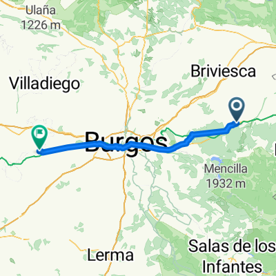
Reto Pamplona - Cadiz<br />Etapa 1, Sector 3<br />Villafranca Montes de Oca - Quintana del puente<br />92 Km
- -:--
- Duration
- 92.2 km
- Distance
- 268 m
- Ascent
- 485 m
- Descent
- ---
- Avg. speed
- ---
- Max. altitude
Continue with Bikemap
Use, edit, or download this cycling route
You would like to ride Reto Pamplona - Cadiz, Etapa 1, Sector 3 or customize it for your own trip? Here is what you can do with this Bikemap route:
Free features
- Save this route as favorite or in collections
- Copy & plan your own version of this route
- Split it into stages to create a multi-day tour
- Sync your route with Garmin or Wahoo
Premium features
Free trial for 3 days, or one-time payment. More about Bikemap Premium.
- Navigate this route on iOS & Android
- Export a GPX / KML file of this route
- Create your custom printout (try it for free)
- Download this route for offline navigation
Discover more Premium features.
Get Bikemap PremiumFrom our community
Other popular routes starting in Espinosa del Camino
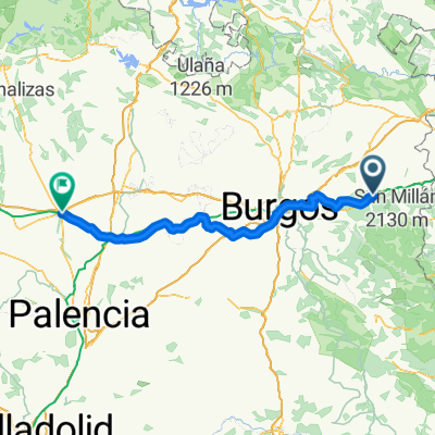
 Zwischenetappe Burgos 15 KM
- Distance
- 15.3 km
- Ascent
- 77 m
- Descent
- 257 m
- Location
- Espinosa del Camino, Castille and León, Spain
 4. Villafranca Montes de Oca - Burgos
- Distance
- 37.2 km
- Ascent
- 351 m
- Descent
- 449 m
- Location
- Espinosa del Camino, Castille and León, Spain
 Camino day 5
- Distance
- 36.9 km
- Ascent
- 316 m
- Descent
- 399 m
- Location
- Espinosa del Camino, Castille and León, Spain
 Espinosa del Camino - Castellanos de Castro
- Distance
- 68.8 km
- Ascent
- 185 m
- Descent
- 137 m
- Location
- Espinosa del Camino, Castille and León, Spain
 Reto Pamplona - Cadiz, Etapa 1, Sector 3
- Distance
- 92.2 km
- Ascent
- 268 m
- Descent
- 485 m
- Location
- Espinosa del Camino, Castille and León, Spain
 8 VILLA FRANCA MONTES DE OCA / TARDAJOS
- Distance
- 48.4 km
- Ascent
- 296 m
- Descent
- 404 m
- Location
- Espinosa del Camino, Castille and León, Spain
 XXXIV° TAPPA
- Distance
- 77.3 km
- Ascent
- 671 m
- Descent
- 812 m
- Location
- Espinosa del Camino, Castille and León, Spain
 Espinosa del Camino - Villamoratiel de las Matas
- Distance
- 137.8 km
- Ascent
- 1,091 m
- Descent
- 1,194 m
- Location
- Espinosa del Camino, Castille and León, Spain
Open it in the app