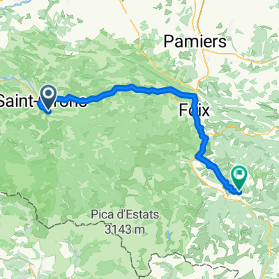
audressein- col de portech-col d'agnes-col de lers-les cabannes
A cycling route starting in Saint-Girons, Occitanie, France.
Overview
About this route
- -:--
- Duration
- 102.2 km
- Distance
- 1,736 m
- Ascent
- 1,727 m
- Descent
- ---
- Avg. speed
- ---
- Max. altitude
Route quality
Waytypes & surfaces along the route
Waytypes
Road
32.7 km
(32 %)
Quiet road
4.1 km
(4 %)
Surfaces
Paved
63.4 km
(62 %)
Asphalt
63.4 km
(62 %)
Undefined
38.8 km
(38 %)
Route highlights
Points of interest along the route
Point of interest after 14.6 km
col de portech
Point of interest after 57.6 km
col d'Agnes
Point of interest after 66.1 km
col de Lers
Continue with Bikemap
Use, edit, or download this cycling route
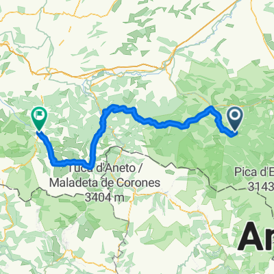
You would like to ride audressein- col de portech-col d'agnes-col de lers-les cabannes or customize it for your own trip? Here is what you can do with this Bikemap route:
Free features
- Save this route as favorite or in collections
- Copy & plan your own version of this route
- Split it into stages to create a multi-day tour
- Sync your route with Garmin or Wahoo
Premium features
Free trial for 3 days, or one-time payment. More about Bikemap Premium.
- Navigate this route on iOS & Android
- Export a GPX / KML file of this route
- Create your custom printout (try it for free)
- Download this route for offline navigation
Discover more Premium features.
Get Bikemap PremiumFrom our community
Other popular routes starting in Saint-Girons
audressein- col de portech-col d'agnes-col de lers-les cabannes- Distance
- 102.2 km
- Ascent
- 1,736 m
- Descent
- 1,727 m
- Location
- Saint-Girons, Occitanie, France
Transpi-carretera-gr10-parte2- Distance
- 352.5 km
- Ascent
- 5,257 m
- Descent
- 5,748 m
- Location
- Saint-Girons, Occitanie, France
Saint-Girons - Ax-les-Thermes- Distance
- 83.1 km
- Ascent
- 1,795 m
- Descent
- 1,318 m
- Location
- Saint-Girons, Occitanie, France
audressein-st. girons-massat-col de lers-les cabannes- Distance
- 91.4 km
- Ascent
- 1,170 m
- Descent
- 1,169 m
- Location
- Saint-Girons, Occitanie, France
4.Etappe: Massad - Audedressin- Distance
- 98.1 km
- Ascent
- 2,740 m
- Descent
- 2,887 m
- Location
- Saint-Girons, Occitanie, France
TDP - ETAPE 10- Distance
- 83 km
- Ascent
- 1,096 m
- Descent
- 1,348 m
- Location
- Saint-Girons, Occitanie, France
MTB Pyrenäenrundfahrt 2 Moulis-Bagneres de Luchons- Distance
- 75.4 km
- Ascent
- 2,268 m
- Descent
- 2,176 m
- Location
- Saint-Girons, Occitanie, France
Itinéraire vers Ouerdes, Eycheil- Distance
- 29.3 km
- Ascent
- 3,110 m
- Descent
- 3,199 m
- Location
- Saint-Girons, Occitanie, France
Open it in the app


